Ghost Of An Old Swamp In The Great Trinity Forest
 |
| High watermark stained trees near the swamp junction of Ash, Oak and White Rock Creeks in the Great Trinity Forest |
This is the remnant of a once vast hardwood bottomland forest that stretched from DFW clear to Florida. It was an integral part of prime wildlife habitat that supported black bears, mountain lions and wolves. Trees dominated the floodplain, forming the basic building blocks that supported other species. Early Indian groups were attracted to the water here. They first used the land to gather the rich bounty of pecans, acorns and walnuts. Then shifted to hunting and later to subsistence farming. Right here in these very woods. Evidence of them is still easy to find today. Early Texas settlers took their cue, staking these very woods as the first homesteads in what is now the city of Dallas. In the succeeding century and a half, these same woods were lumbered for building the first structures in Dallas, later the plow took over and this same area became the most fertile farming land in the state. Pockets of this old hardwood bottom still exist. They are hard to find, hard to traverse and hard to explain unless you have been there yourself.
 |
| Knee deep hiking through a crystal clear hard bottomed swamp |
Looking at a map, the bodies of water here have no name. No signs exist, no tell tale trails to guide you across what little dry ground is down here. Those who rely on Google Maps, printed maps and aerials will quickly find themselves humbled by an area that scarcely resembles that as viewed on the internet. It’s deep and dark. The maps will betray you here. On a cloudy morning you will lose your sense of direction. Every tree, every opening, every thicket all looks the same. Towards sunset it could puzzle even the most seasoned hiker. It’s a place where few if any mistakes are allowed. A bobble, a fall, a twist of an ankle could be the catalyst towards a life threatening situation.
I have been in this area a number of times before. An area where White Rock Creek begins to slow and meander into a complex cursive shaped set of U’s before entering the Trinity River. The best and safest street address for access is the 3000 Municipal in the Rochester Park neighborhood. If one wanted to lengthen their mileage some, parking is also recommended at the Buckeye Trailhead located at 7000 Bexar. On weekends, especially Sunday, I would recommend parking at the Bexar entrance since the Lord’s Missionary Baptist Church nearby holds services most of the day. Far safer than parking in Rochester Park.
 |
| William Blair/Rochester Park Trails |
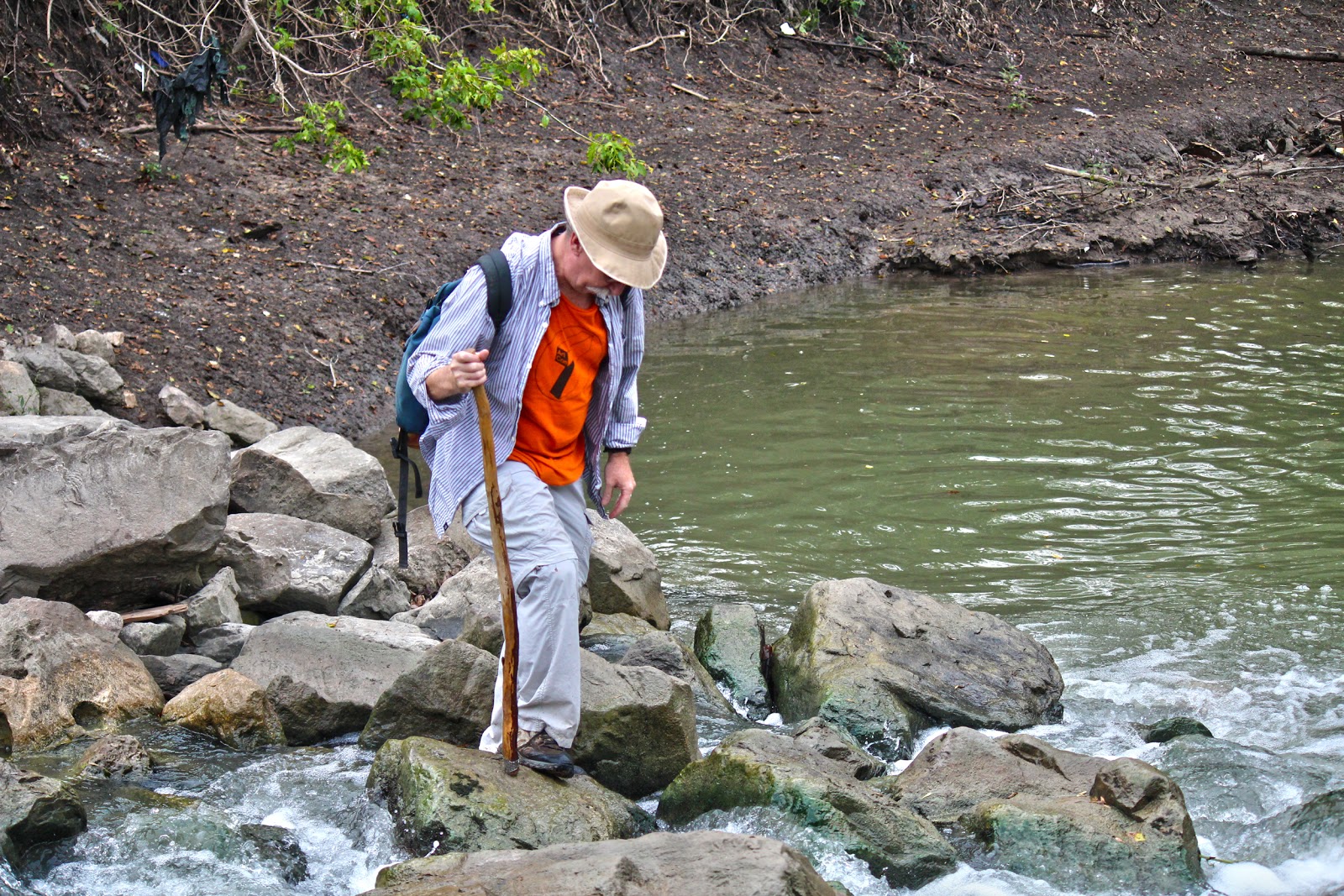 |
| Crossing White Rock Creek in Rochester Park |
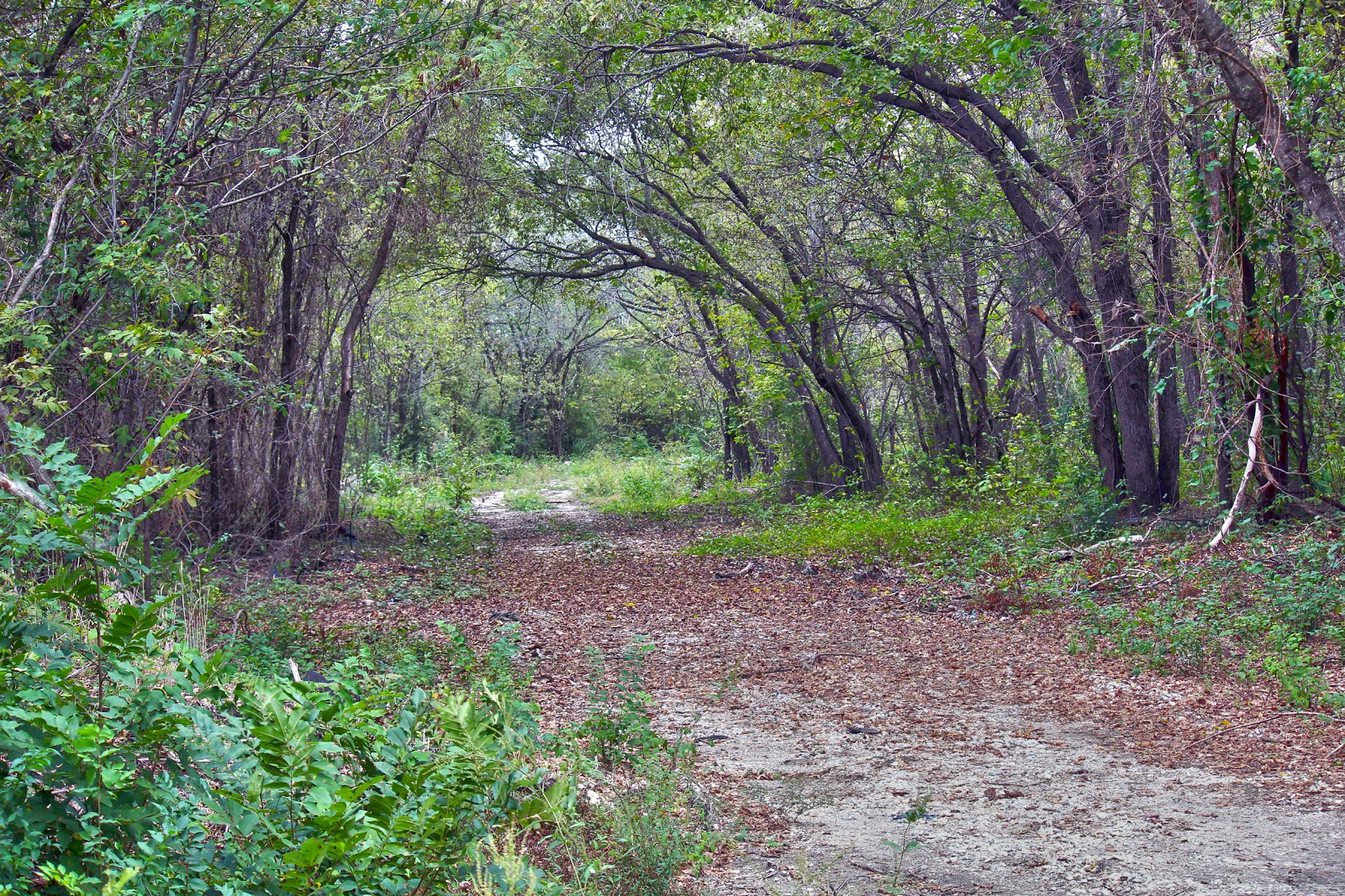
The map above is by no means complete. It represents some of the more maintained trails in this section of the Great Trinity Forest. Not represented on the map is a trail that begins near the lake and roughly follows White Rock Creek to the terminus with the Trinity River. The particular hike mentioned in this post, the swamps and hardwood bottoms follows a Dallas Water Utilities Right of Way and ONCOR Powerline as noted in the upper right hand corned of the map. No trail from there, blaze your own!
Crossing White Rock Creek along the right of ways is made easier by the rocks placed by the utility companies to prevent erosion. Seen above, this crossing is located not too far from the Rochester Park Levee and is only a short 5-10 minute walk.
 |
| Crossing White Rock Creek in Roosevelt Heights |
 Upstream is another concrete crossing of White Rock Creek which leads to the real heart of the swampy bottoms. The crossing seen above is along a Dallas Water Utilities right of way which hitches off from the ONCOR high power transmission lines near Rochester Park. If you refer back to the map above, you can see the route which will take you there. This particular crossing will put you at the back end of lower Roosevelt Heights and an area recently described as “Tune Avenue” in an article by Jim Schutze in the Dallas Observer entitled The Bushwhacker’s Guide To Exploring Dallas. The article notes the location of Tune Avenue near the junction of Second and 175 but I would never recommend leaving a vehicle there unattended. Since you’ll be getting your feet wet anyway, park elsewhere.
Water and where it flows dictates the terrain in a swamp. Hiking in other environments you can find higher ground to work your way out of bramble thickets and tight spots. Not so in a submerged area. Here, literally going with the flow, is often the path of least resistance. That means the water is often deeper but also easier to navigate through the vegetation. It might seem kind of spooky at first but there is some deeply hidden primal instinct one taps into about ten minutes after getting your feet wet. Getting your swamp legs is what the Acadians call it.
Roosevelt Heights
 This is a part of town that Dallas gave up on forty years ago. Named after President Franklin D Roosevelt and his New Deal programs that are believed to have spurred development of low income housing in this area. Reading up on the background I think most of the Roosevelt Heights area was developed in the post war boom of the 1940s at a time when Dallas saw an influx of skilled African American laborers from East Texas. The epic drought of the 1950s in Dallas allowed home construction in areas well within the 100 year flood plain. Unaware for years that their new homes were in peril when normal rain patterns returned.
Roosevelt Heights grew in the interim. A population of less than a thousand, three churches, two grocery stores, hair salons and a sundry store or two. It was a real community. That came to an abrupt end in 1957 when Roosevelt Heights saw the first major sustained multi-day flood. The aerial photo(inset) shows the extent of the flooding that spring which inundated Roosevelt Heights and Rochester Park. In the photo, Second Avenue can be seen running lower left to upper right. Roosevelt Heights in the foreground and Rochester Park in the background left. Many of the refugees from this flood were forced to live in railroad boxcars until flooding subsided. Few moved permanently after this flood.
The 1960s brought flood after flood to Roosevelt Heights. The flooding was magnified by new levee construction upstream and urbanization of former agrarian lands. The result was not a devastating flash flood but a backing up of flood water from the Trinity into the White Rock watershed. In the early 1970s, talk began of flood control improvements. Rochester Park was earmarked for a levee and Roosevelt Heights was bought out by the city. In the lower section of Roosevelt Park, the last homeowners around 1973. North of US175, one homeowner still resides today.
 |
| Intersection of Roxana Avenue and Bush St, Roosevelt Heights, October 2012 |
Since the 1970s, the area fell into extreme neglect. The grid of old streets served as a favored illegal dump for cars, tires, shingles and the occasional human. During those forty some odd years of abandon, the outer areas of this bottomland began to heal. Trees slowly began to take root, old farmed areas went to seed, then weed, then tree. Groundwork Dallas has done much of the volunteer cleanup of this area, removing scores of old tires, appliances and furniture. The patchwork grid of old asphalt roads is by no means pristine but much cleaner than it was a few years ago.
 |
| White Ibis above Roosevelt Heights |
The 1998 bond for the Trinity River Plan lists Roosevelt Heights as a future campground. I imagine if it were really cleaned up and with a number of basic services like water, restrooms and security, it could serve as a viable area for RV visitors to the State Fairgrounds or the ever popular chuckwagon roundup horseback rides held across the river in Joppa.
Like the the old Floral Farms “ghost” neighborhood off Simpson Stuart, the old Roosevelt Heights area does give one an interesting look into how the natural environment works to reclaim areas if people leave. Saplings growing through tires, brush growing across old driveways, cracked foundations hosting colonies of cactus.
Roosevelt Heights sits just ever slightly above three creek intersections on a small peninsula rise of land running north to south bisected by US 175. In the southern half, large swampy ponds sit on either side of the peninsula. In the last several years 2008-2011 these swamps have gone bone dry no later than mid June. This year, 2012 was somewhat different. I was surprised to see the bodies of water close to capacity. I had planned on our hiking party crossing a dry bed here and was taken aback that so much water held here all summer. Beavers. Lots of them. Nature’s engineers. They have constructed large and complex sets of dams through the bottoms here, keeping much of it flooded through even the hottest parts of the scorching Texas summer. A great example of their work can be seen below. The first photo was taken in October 2012 of the water body just east of Roosevelt Heights. The photo below it was taken in June of 2009, about a week after the pond went dry.
 |
| October 2012 |
 |
| June 2009 |
I think the photos should be just about dead on in the same spot using the treeline in the background as a frame of reference. The mass of willows in the middle of the pond has really grown in the last few years and I believe now hosts a beaver lodge.
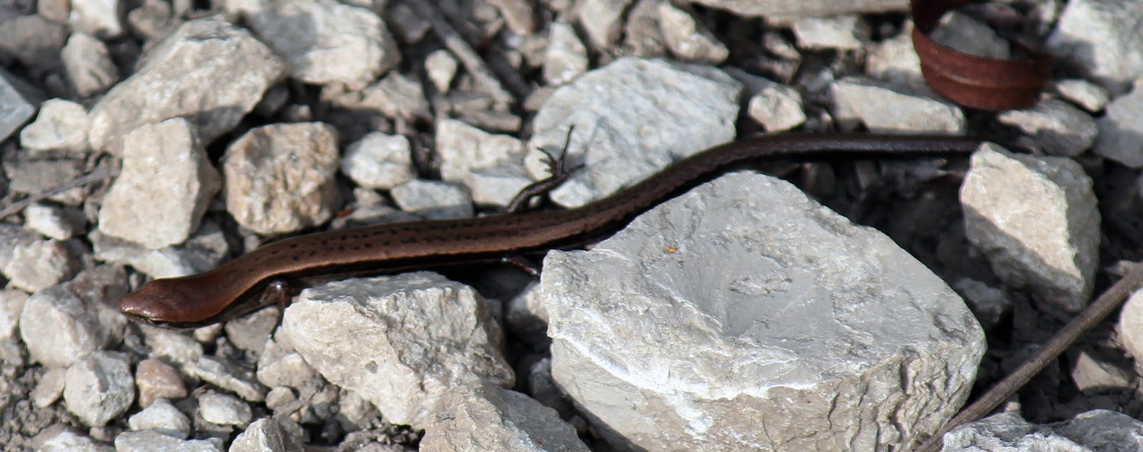 |
| Texas Ground Skink |
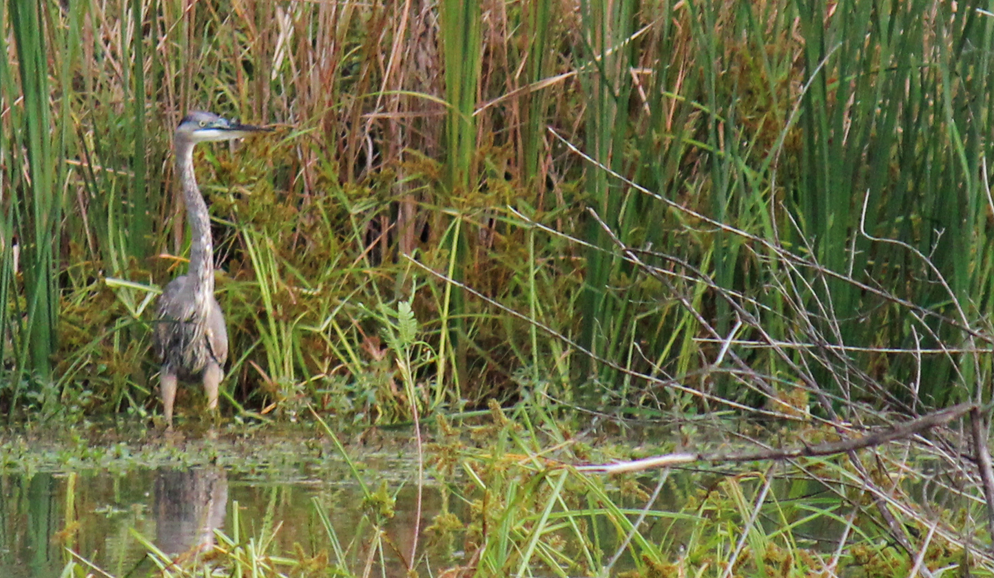
The impoundment of so many acres of water has drastically increased the amount of waterfowl seen in this area. Wood Ducks, Diving Ducks, Cormorants, Ibis all seem to have taken up residence here. In the late spring of 2009 and 2010 these ponds hosted the earliest sightings of Wood Storks and Roseate Spoonbills on record in Dallas.

Even the intersection of Bryan’s Slough and Oak Creek now hosts a sizeable beaver pond. Using an old set of abandoned concrete pipes as a base, the beavers have steadily built up their dam using mud, willow and nightly cuttings of giant ragweed.
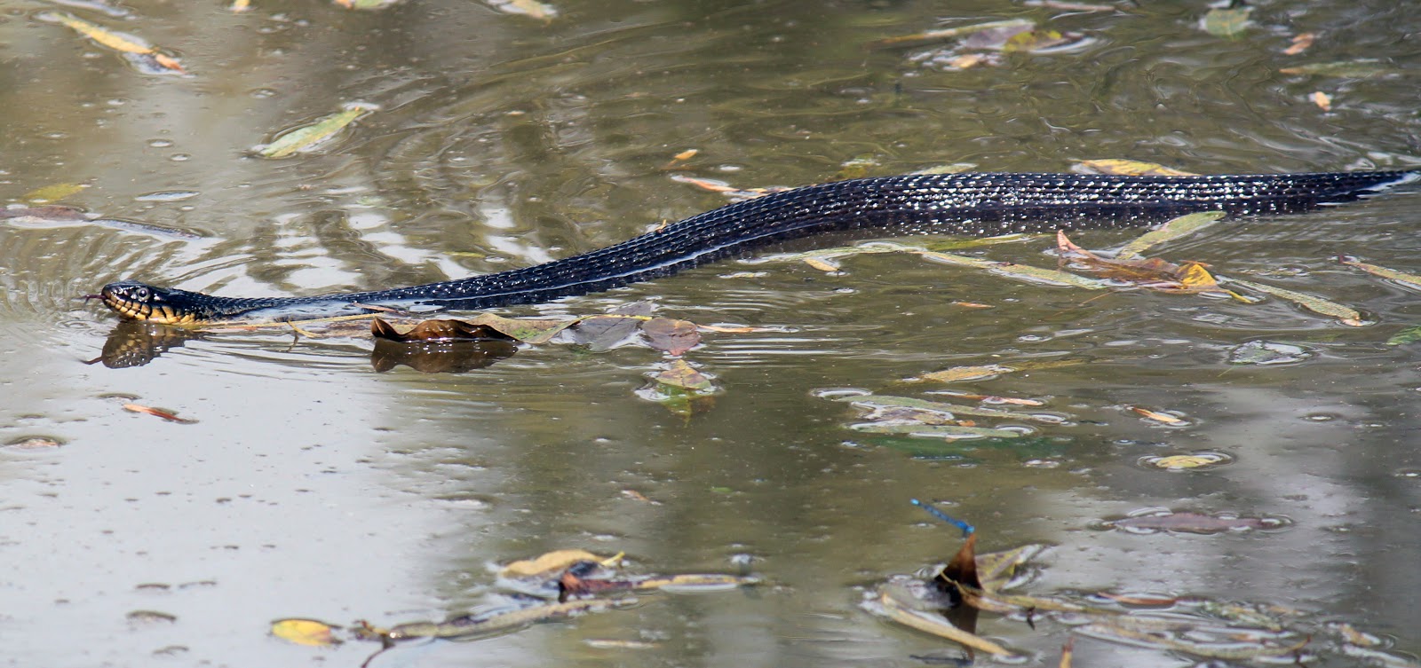 |
| Yellow Bellied Water Snake |
 This rather large water snake a native to Texas is called a Yellow Bellied Water Snake. Slender in appearance and with a rounder head than a Water Moccasin, these snakes thrive in the backwaters here. This particular snake was a little too friendly and got a little too close for comfort as I stood on the beaver dam here. Had I not moved I believe it would have slithered across my feet.
The fish population here really thrives. Like most I thought that below White Rock Lake the fishing would be quite poor and worse the further downstream one goes. Not true. I have been placing underwater cameras over the summer in various creeks and sloughs down here, one of the more remarkable was recently in the Bryan’s Slough/Oak Creek drainage. This is in an area where Big Spring aka White Rock Spring drains off an into a larger creek. Nearby homeowners, Mr and Mrs Pemberton told me about schools of catfish they spotted on a recent walk of their property. I placed a camera in the water for a couple hours.
Sure enough, the camera caught not just catfish but also a black bass. The fish I believe travel between the swamp areas we walked through and this small creek like channel. During large floods, this area is completely inundated by the Trinity. Left behind are often gars and rough fish like carp.
The Black Bullhead Catfish seen in the clip are most likely a brood hatched in early summer, biding their time before the next big flood carries them away. They are a smaller non-sporting version of the channel catfish which most Texans are familiar with. The Black Bullheads feed on almost anything dead or alive while the channel catfish prefer to eat only live quarry.
Rare to see a bass though. The particular bass in the video is a native Spotted Bass, one that is unlike those of Florida strained bass stocked in area lakes. Or so I have been told by a biologist. The water clarity is a result of the strong flow of spring water off of Big Spring.
 |
| Gulf Fritillary in the Great Trinity Forest |
The Gulf Fritillary or Passion Butterfly are currently migrating through the area. Monarchs, Buckeyes, Viceroys and Queens add to the mix. Fond of nectar bearing flowers, some flowering areas around these swamps were just loaded, hundreds of butterflies at a time. The Gulf Fritillary seen here might travel as far as Argentina to winter. A long trip.
A Note On Personal Safety
With regret on this outing we came face to face with an armed pair of poachers in Rochester Park carrying shotguns. They were actively bush meat hunting and firing their guns at birds sitting along the high powerlines not far from the levees. It’s unfortunate that not much can be done to stop these individuals from hunting within our city parks. While our encounter was brief and I did all the talking, I cannot underscore the personal safety one needs to take this time of year in areas frequented by armed poachers. Don’t dress like a deer! Wear an orange hat, day glow vest or something that screams human not four legged. Don’t be a hero if you see something happening. I was an idiot for confronting them and should have just gotten as far away as possible. Take note of their vehicle, description and call authorities. I would say call 911 but the police won’t show when I call.
Poaching and game crimes can be reported directly to Texas Parks and Wildlife here:
1-800-792-GAME
Operation Game Thief