William Blair Park – The Perimeter Trail
 |
| Sunrise over the mouth of White Rock Creek at the Trinity River |
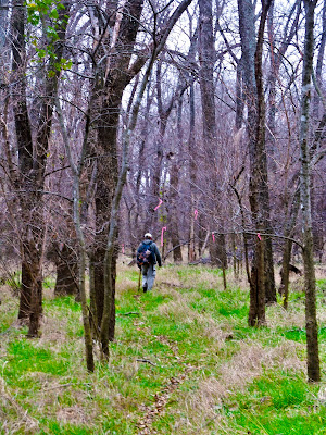 |
| Flagged trail from Buckeye to White Rock Creek |
The terrain here for the most part is pancake flat. Most of the trees in this section of William Blair Park are 40-50 years old, punctuated by the occasional Bur Oak or Bois d Arc tree that is much older. Bill Pemberton, a local resident told me that much of this land near White Rock Creek was open pasture until the middle part of the last century. When the land was sold to the city much of it reverted to a pioneer class of forest. Unlike the Buckeye Grove upstream this area is blessed with a lack of invasive privet. As a result you can see a couple hundred yards in every direction while hiking.
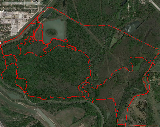
Mileage wise, the route we took around the perimeter of the park was about 5 miles. Another five miles of trails exist inside that. Some of which is a paved ADA certified trail to an overlook. The island in the middle of the lake is easiest to access from the south. In the warmer months the shore of the island is full of water moccasins. Watch your step. This lake did not go dry in the drought of 2011 and I did not see a fish kill. I suppose the fish population which includes a healthy number of catfish is doing well.
http://connect.garmin.com/activity/139957375
I included in the map photo above some of the routes I have taken in the past on the east side of White Rock Creek. I would classify these trails in the category of marked but unmaintained. The trails see far more coyote traffic than human. They are marked to some extent and make for rather easy hike considering the lack of established trail. It does not lend itself to mountain biking but would be great for off leash dog hikes.
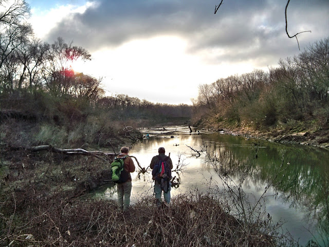
The only difficult areas are as you approach the mouth of White Rock with the Trinity River. The confluence forms a two story peninsula of sorts that extends about 100 yards out towards the river. The top of the peninsula is fairly thick with greenbriar and somewhat of a challenge to negotiate. A machete makes quick work of it. Two minutes with my parang and it was easier to get through. No big deal.
 |
| Belted Kingfisher |
The payoff for going to remote parts of town like this is the true wilderness you encounter. As I mentioned, this is one of the few places left in the United States where you can view an intact expanse of old growth forest. It’s only a fluke that during the rapid expansion and growth of Dallas as a metropolis that the a few hundred yard deep buffer of trees was left on this section of the river. Here you will find the largest trees in Dallas and bird species that they attract. To the left is a Belted Kingfisher that flew directly over our head before landing on a snag in the river in front of us.
The past few winters, Bald Eagles have been seen in this area too. Migratory non-nesting pairs who hunt for the ducks that call the wetlands in this part of town a winter home.
The Burning Bush On The Trinity
 |
| Chagall’s Moses And The Burning Bush |
Maybe it was an Eastern Wahoo Tree, Bill Holston and a mess of feral pigs that could have been the inspiration for Marc Chagall’s rendition of Moses And The Burning Bush?
 |
| Eastern Wahoo Euonymus atropurpureus Buckeye Trail |
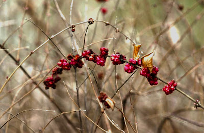 |
| Coralberry Symphoricarpos orbiculatus |
Also of note is the Coralberry, a close relative of honeysuckle. This time of year the pronounced pink berries stand out in contrast to an otherwise muted view of the woods.
Metzger’s Dairy
Much of the land where William Blair Park now sits was once a dairy farm.
Joseph Metzger, a Swiss immigrant and the founder of Metzger’s Dairy, crossed into Texas holding his only possessions in a pack above his head while the Red River was at flood stage in 1875.
 |
| Christian Moser |
Metzger proceeded to Dallas where he tried farming in the community of New Hope(Mesquite/Sunnyvale) in Dallas County. Not experiencing much success in that endeavor, he later worked for Chris Moser, one of the Southwest’s first dairymen. In 1889 her rented a farm in the vicinity of North Carroll, Haskell and Ross Avenues where he began his own dairy with the purchase of 40 cows and a horse drawn milk wagon.
In 1893 Metzger began purchasing land within the old John M Crockett survey for the purposes of relocating his dairy. At that time 64 acres were purchased less 1.8 acres which were to be used as the county road known as Miller’s Ferry Road. Thus began a succession of street names(later Holmes Street and Hutchins Road) for the street now known as Lamar Street. A deed dated February 28, 1893 and filed the same day describes the land as extending from west of the railroad to the river. Metzger continued to acquire parcels of land until 1904. After all purchases were made, the farm which became the home of Metzger’s Dairy contained 159.6 acres.
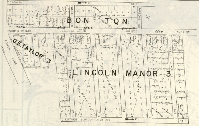 |
| Original Bon Ton Addition Plat |
The property abutted the old O.E. Taylor property on the east, and extended as far northeast as the Bexar and Parsons intersection. The Bon Ton Addition at that intersection was sold to the city by Mrs Metzger in 1932. The Trinity River was the southern boundary. There was a cotton seed oil company southeast of the dairy headquarters on the east side of present day Lamar.
 |
| Metzger’s Store location 1900 (red dot) |
Just like the Pembertons on the east side of the creek, in addition to the dairy business Metzger ran a store down by the river. It is possible that the store shown on Sam Street’s Map of 1900 was this establishment. Metzger’s store was destroyed by the 1908 flood. The structures on the dairy property, both houses and barns were apparently never inundated by the river. The Metzgers had a notched stake placed near a barn that served as a barometer on river flooding. If the water rose to certain marks on the stake the workers knew that they would need to relocate cattle from certain pastures.
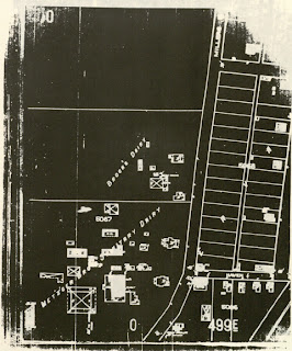 |
| Dairy location and buidings circa 1922 |
The Metzger store also served as the main whiskey supplier for much of Dallas County and points south between the Dallas and Corsicana train stops. Whiskey deliveries were made every Friday to outlying areas of the countryside. This small small store later became what was known as Mister M Food Stores. The “M” in Mr. M, being Metzger.
 |
| View from Lamar across from the Borden’s Dairy |
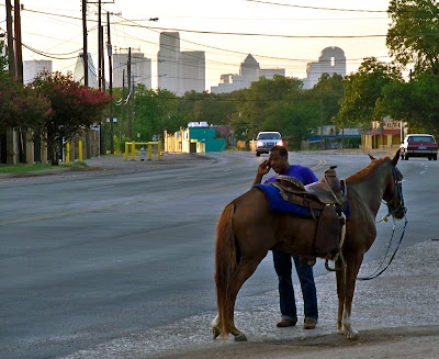
Metzger’s dairy flourished and by 1909 was purchased by Joseph Metzger’s sons Carl and David. In 1922 it was listed in the Dallas Directory as Metzger Brothers Sanitary Jersey Dairy. At the time the dairy was considered the largest and most modern in Texas. The first Dallas dairy to use glass bottles. Following World War II, the rapid expansion of Dallas led to an expansion of the facilities. The Metzger family involvement ended in 1984 with the sale of Metzger Dairy of Dallas to Borden.
Deer in the Park
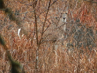
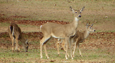
Luckily during the rut this fall, I was able to photograph a few nice sized does and some yearlings in the park proper. On the flood protected side of the levees. They were browsing out in the open which was a welcome change from the usual panicked escape I usually invoke. Deer are becoming more and more common in this area which is a nice thing to see. Plenty of food for them to eat and a sign that things are getting better rather than worse.
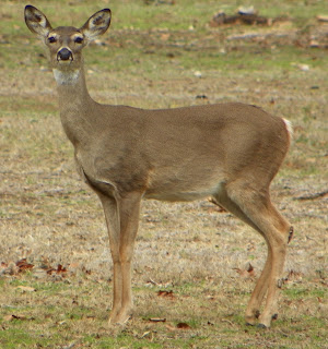 |
| William Blair Park Whitetail |
The Future
The contractor’s street project wraps up in about two months. He mentioned that the area is safe to park in and that the residents south of Budd are all nice folks.
