Trinity Trail Between The Levees — A Promised Path By 2014
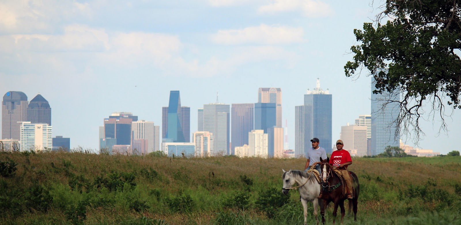 |
| Horseback at the confluence of the West and Elm Forks of the Trinity River, near Historic Eagle Ford, West Dallas, Summer 2012 |

The Trinity River has long been the greatest of divides in Dallas. Originally a temporary hermit camp on the riverbank turned into one of the great metropolitan cities in the world, Dallas wrestled with the Trinity since the infancy of the town itself. Often viewed as not just a geographic boundary but also one that divides residents by socioeconomic groups, political affiliations and race. A festering wound that won’t heal. Some see the less than lukewarm success of the 1998 bond program to build amenities in the floodplain as a metaphor for the disfunction of the city as a whole.
Most of the critics that think that way have never been down on the river. Never stood on the bank, walked the woods, seen the wildlife or been patient enough to watch a sunset. I pity them. Often with the biggest soap box and megaphone they point to the blank canvas of barren floodway that they drive over everyday and think how boring and ugly. Hard to blame them. Fair enough. They make valid points but rarely offer solutions to what has vexed Dallasites for generations.
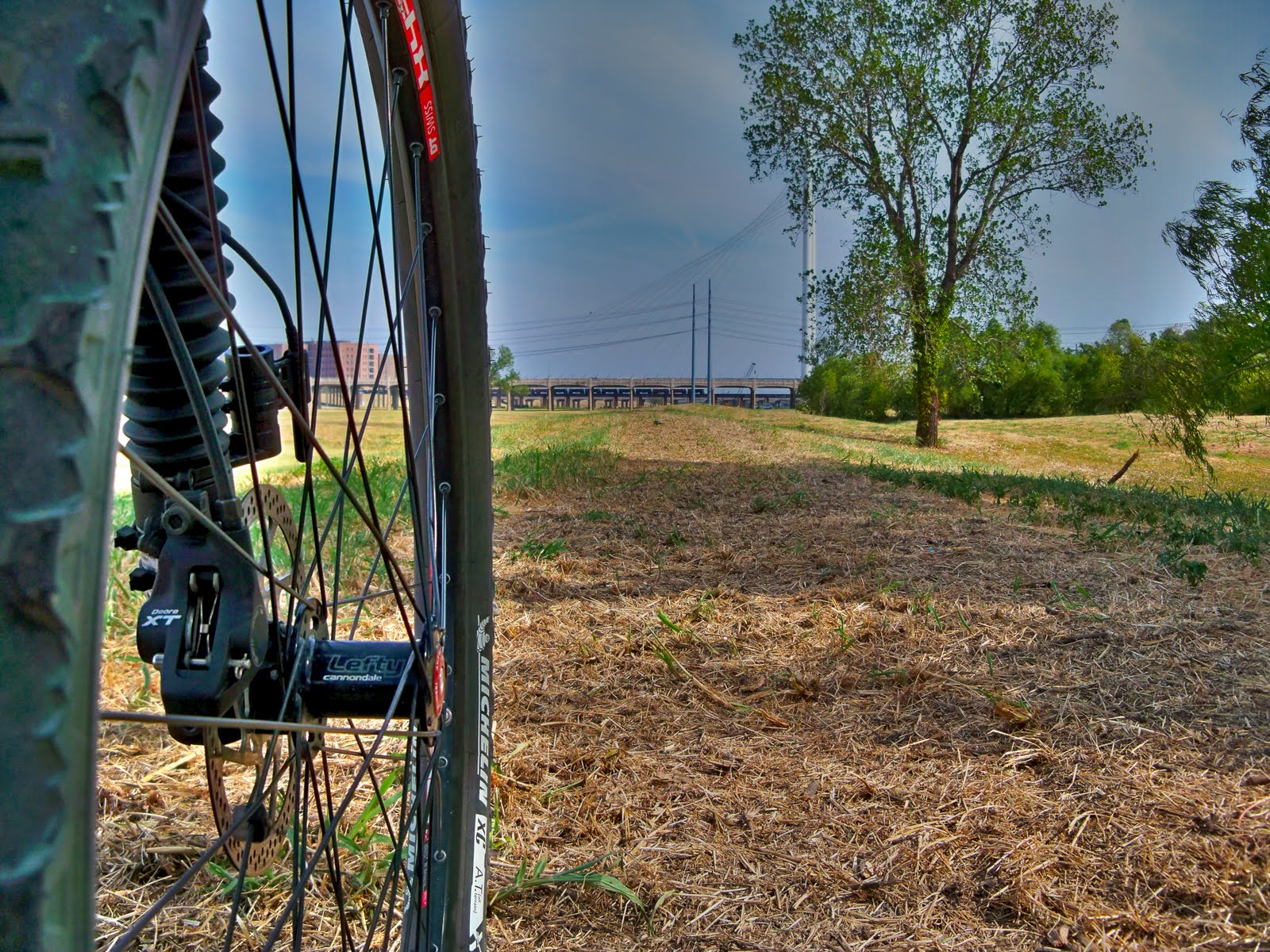 |
| Riding the DORBA Trinity Trail near the Calatrava Bridge September 2011 |
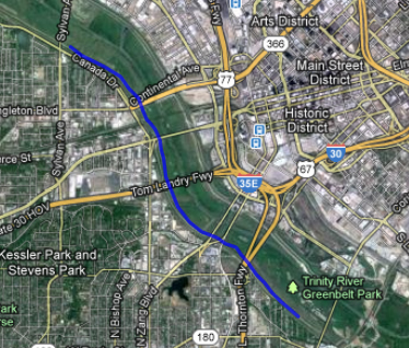
Once in a great while, someone wants to change that. Almost exactly a year ago City Council members Angela Hunt and Scott Griggs launched a grass roots, low key initiative to put a soft surface trail in between the levees. More of a proof of concept idea turned reality, the trail meandered from Crow Park at Sylvan Avenue to I-35. It was a trail scalped out of the grass, leveled in spots and easy to ride by bike or horse. With the heavy fall rains and flooding I think that idea was put out to pasture, so to speak. The trail was complete though.
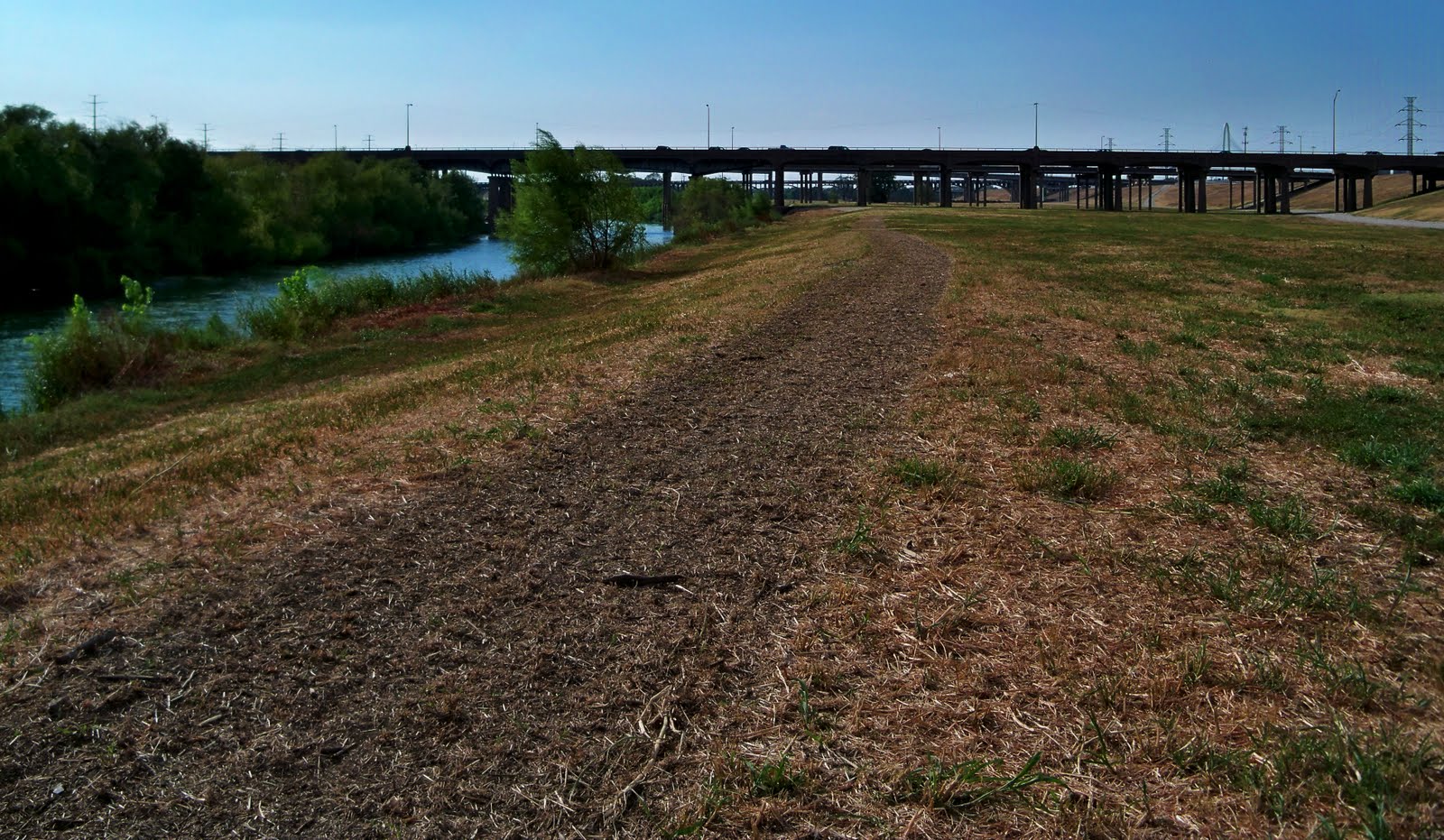 |
| Angela Hunt and Scott Griggs concept trail turned reality on the Trinity River as viewed from Mill Creek looking west towards I-35 |
The trail was proof that with just elbow grease and a tractor that something useful could be cobbled out of something that already exists. Due to the close proximity to the river, the trail evaporated under substantial winter flooding. A+ for effort. People look down on the river from the lofty heights of Downtown buildings wishing someone would do something, anything. Here it was. Even if just for a few weeks there was a trail down there.
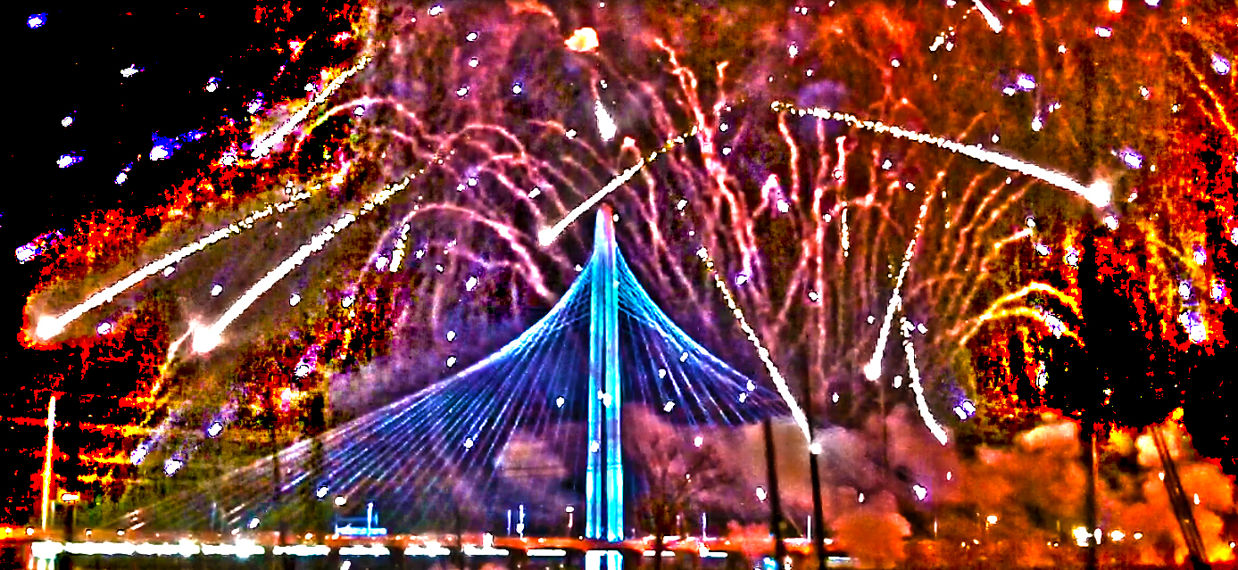 |
| Time exposure of Margaret Hunt Hill Bridge Fireworks show, March 2012 |
2012 was billed as a new beginning for the river. A turning point at which many of the promised projects would become a reality. March saw the opening of the Santiago Calatrava designed Margaret Hunt Hill Bridge and with it a renewed promise to bring more river amenities to the city. The promises were made by folks who have stayed silent since then which raises my eyebrows some about the sincerity of their remarks.
The New Plan — A Bigger Better Bolder Permanent Route
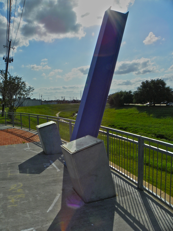 |
| Trinity Strand Trail 1908 High Water Marker |
The newly proposed 2012 route somewhat shadows the 2011 route on the other side of the river. Extending from Crow Park at Sylvan Avenue, the 16 foot wide path would stretch south down the river to the Santa Fe Trestle Trail near Moore Park. The “trail” or “path” should be a term loosely used here. The primary use of the concrete trail/path/road would be for maintenance vehicles and secondary would be recreational use. Dallas City Manager Mary Suhm said to look for the trail in 2014 which is an aggressive timeline considering the slow progress of other projects on the Trinity.
I think the trail itself should be thought of as a connection to other trails not a destination itself. Using the open floodplain to connect various projects is a masterstroke of ingenuity and making the best use of open land.
Part of the plan is to formerly tie in the Coombs Creek Trail in Stevens Park with the Trinity River. The Coombs Creek Trail provides great access to the heart of Oak Cliff, winding up the creek shaded by pecans most of the way.
The other trail connection would be the yet to be completed(or really even started) Trinity Strand Trail which should link the Katy Trail with the Trinity River. This tie in would be right around the upstream of the Sylvan Avenue Bridge near the Baker Pump Station.
I cannot overstate that if one were to believe that the proposed trail would be a destination unto itself they would be disappointed with the final product. It should be seen as a way to connect other projects or provide access to other places, other trails and other sites.
Why concrete?
The Corps of Engineers has quite a bit of say in what is constructed between the levees. They like concrete over any other material. The Corps broadly uses the power it was granted under The 1899 Rivers and Harbors Act to control what is built along rivers and streams across the country. Bloomberg has a great article that sheds light on why the Corps meddles and injects itself in so many things…
http://www.bloomberg.com/news/2012-08-21/why-is-the-army-corps-ruling-your-neighborhood-.html
 |
| Old River Bluff looking up at Courthouse |
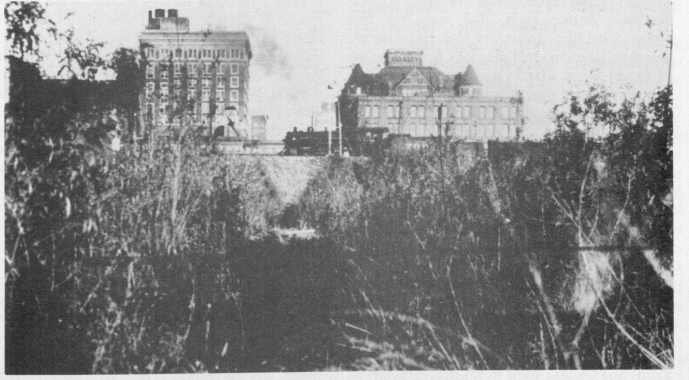
Critics of the new plan for a 16 foot wide trail between the levees will say concrete will scar the natural landscape or the river will be ruined. I don’t believe that to be the case. The river channel between the levees is not natural to begin with. It’s merely a diversion channel that takes the Elm and West Forks of the Trinity River off their natural course over a mile. The original course of the river is illustrated below in this undated photo which should be from around 1915 at the latest. The river at that time was much further to the east and ran through the Industrial and Medical District that we know today. The confluence of the West Fork and Elm Fork of the Trinity River was at the southwest corner of present day Irving Blvd and Inwood. The river channel is still there today. Archeological digs at that river junction have found old campsites at this confluence. Those radio-carbon dated are shown to be from the 1700s. Much older fire hearths and camps sit below the dated site.
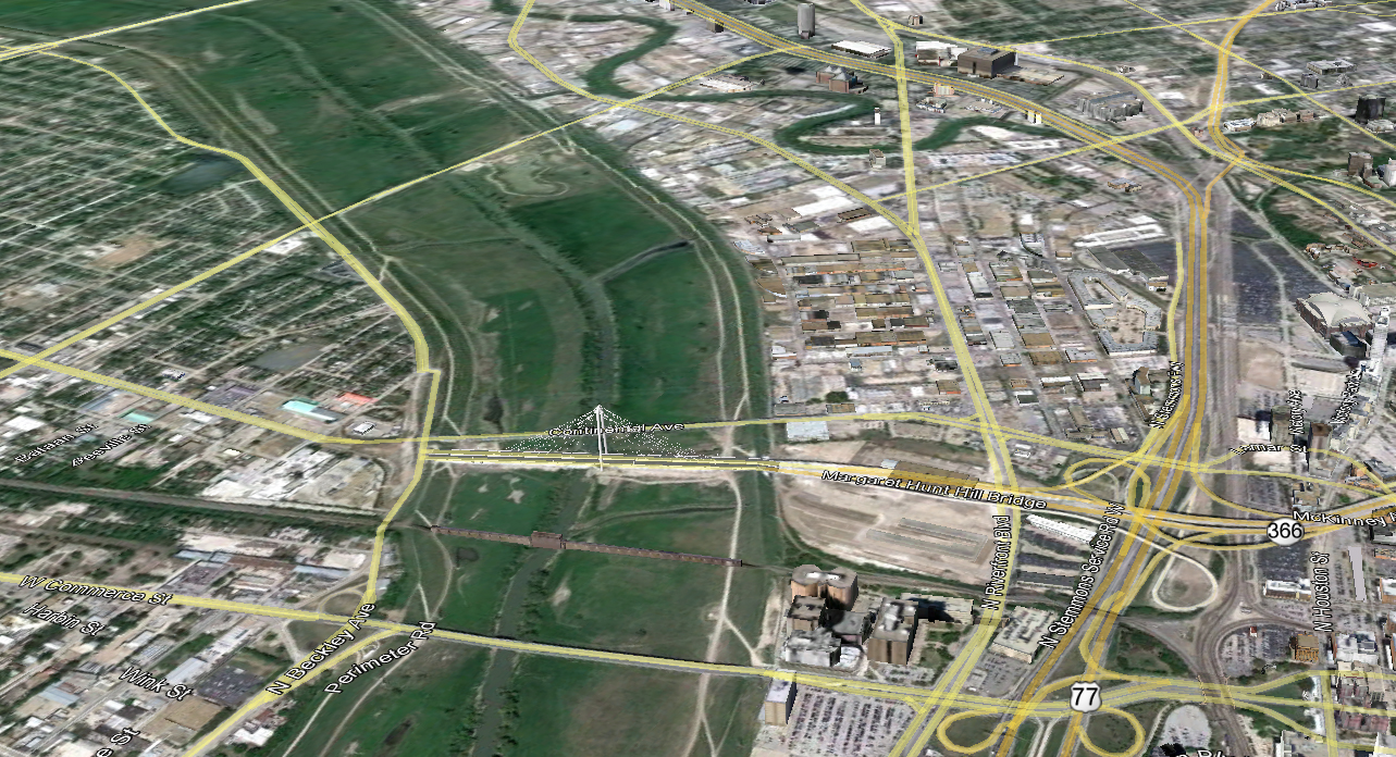
Below are two looks at the river taken roughly 100 years apart. The older photo dates before the First World War, the comparison below it is from Google Earth in 2012.

The Chambers Mule Barn sits about where the Dallas County Jail sits today. The wooded island above it, a cutoff of the river channel is called an oxbow. The island went by a couple different names and was often seen as a place for petty outlaws to live in, sheltered from the prying eyes of the law. Looking at that photo, much of the formal 100 year floodplain at that time was fenced off and used for pasture land or agriculture.
 |
| Rare Tricolored Heron in old creek channel near Trinity River, Summer 2012 |
The small creek running(close to the notation T&P Railroad) south and parallel to the river has no name. It now sits on the north facing side of the south levee and during wet weather forms a reflection pool of standing water west of the Margaret Hunt Hill Bridge. The bird in the photo above, a tricolored heron is in that old creek channel fishing in the water holding there in June.
 |
| Fuel City Longhorn–Old River Channel in the roadbed |
Near Reunion Tower and the old Reunion Arena site, the old river channel ran down what is now Riverfront Blvd. The channel ran through the widest span of the Houston Street Viaduct which now sits almost 1/2 of a mile from the present channel. The old channel ran through the present Fuel City Truck Stop/Tacorama then past the Old Sportatorium site on the east side of I-35.
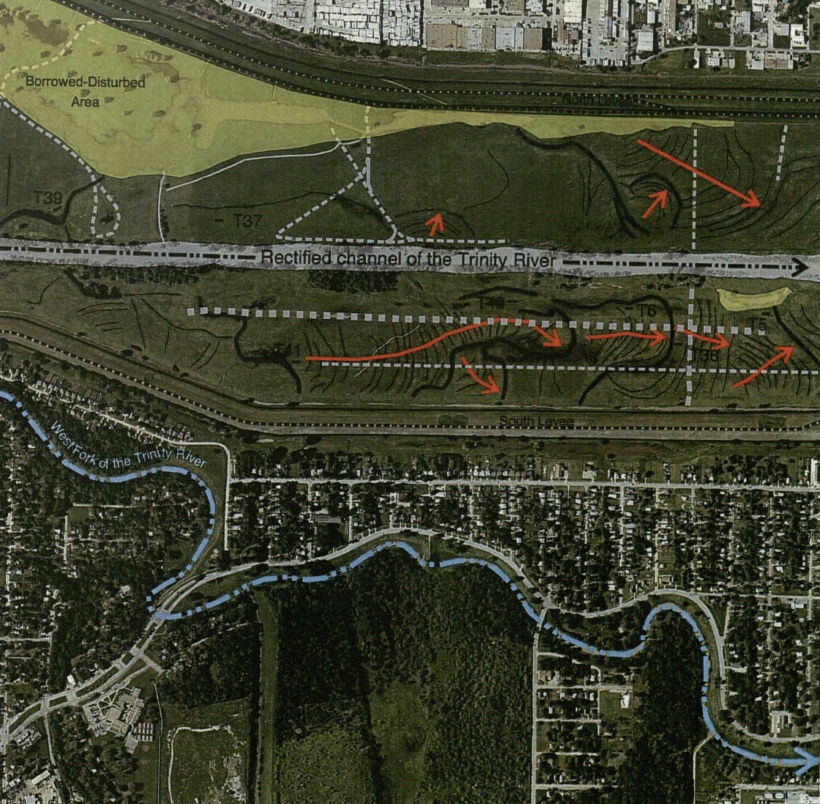
Further upstream in West Dallas where office parks and strip warehouses have not been built over the old channel it is much easier to find remnants of the old river channel. Above is a graphic illustration of the old channel of the West Fork and how it was moved some distance north. Hard to believe so many homes were built in this area right up against the edge of the old riverbank. These flood prone areas have some of the lowest elevations in Dallas. If the levees were ever to give way in a large flood, these homes would be under 40 feet of flood water.

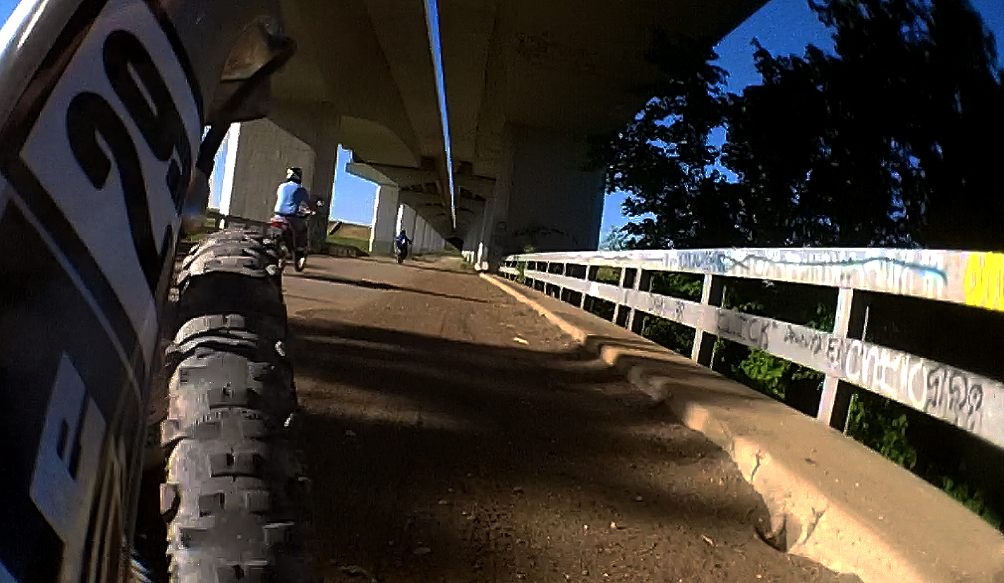 |
| Motorcyclists using the old Mockingbird/Westmoreland Bridge |
Known as the Devil’s Back Porch, West Dallas was the epicenter in Dallas County for disease and crime. Illustrated in the map above you can see how the old cutoff slackwater meanders of the river became a breeding ground for typhoid, cholera and malaria. Similar to the West Nile Virus scare of today, some neighborhoods saw the curse of these diseases more than others. West Dallas saw the worst. To combat flooding in the future, Dallas is building a large 3 story high Pavaho Pump Station to drain much of this basin. David Mimlitch has some great aerial photos taken this month of that new facility which can be found on his flickr page
Aerial photos of the new Pavaho Pump Station
What’s useable now?
 |
| White Ibis Flock Near Continental Viaduct |
I think one of the misnomers about the levees is the open access. Other than a few spots with ongoing construction of the new Sylvan Avenue Bridge or slurry wall work on the north levee(called the east levee), the levees are open to the public using non-motorized transportation. I know that there is some apprehension about going some place new or getting off the beaten path. The levees are pretty safe. Especially between the Commerce Street Viaduct on the south side and the Westmoreland Bridge upstream.
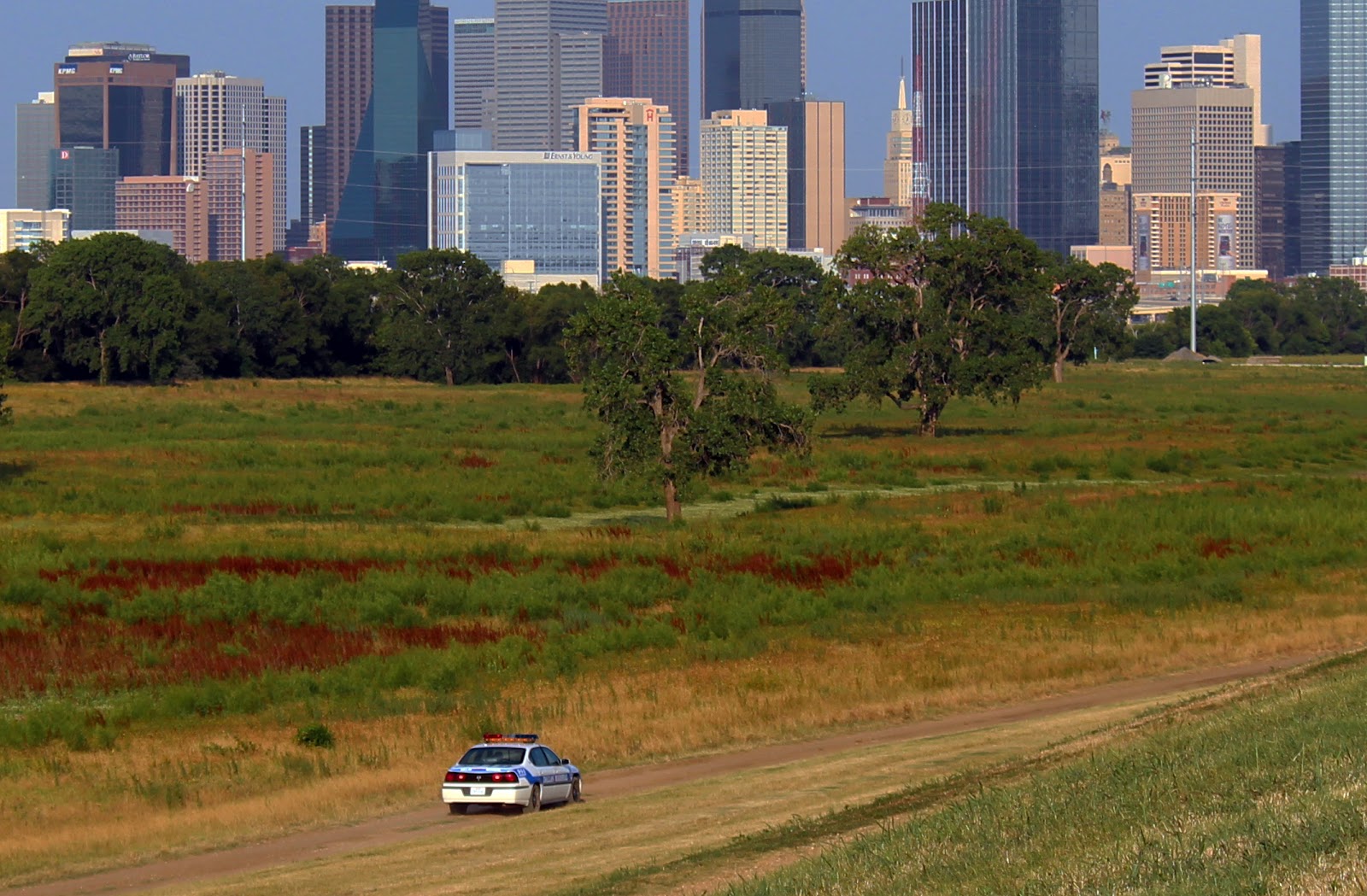 |
| Dallas Marshal patrolling the levees summer 2012 |
 Patrolled frequently by the Dallas Police Department and the Dallas Marshal’s Office it seems to be pretty safe. Gone are the days of homeless sleeping under the bridges. That ended about the time construction started on the Calatrava Bridge. The neighborhood gets rougher on the downriver side of I-35 on both sides of the river. Loose dogs and the occasional homeless person on the river side of the levee make the access road between I-35 and the Santa Fe Trestle Trail a little more sketchy. Still safe, I would just be aware of the dog issue(really bad dogs) and the wayward wandering homeless.
Crow Park is host to soccer fields and a cricket field/pitch. On most weekends there are quite a few people there and can be considered safe year round.
How to get there by car:
Directions to visit the levees are simple, providing you are not using a motorized vehicle. In a car, formal parking is really limited to Crow Park at 3700 Sylvan Avenue between the levees. This parking might vanish in the next several months with ongoing construction of the new Sylvan Avenue Bridge.
Parking for the southern end of the levees where the Santa Fe Trestle Trail and Dallas Wave are located would be at the Corinth Street DART Station 100 South Corinth Street. One of these years, parking for the Santa Fe Trestle Trail and Dallas Wave will open. Until then the DART Station is your best bet.
How to get there on foot/bike/horse:
Simple. Pick a spot and climb over the levee. From the Katy Trail, simply take Victory Avenue west under I-35, left on Oak Lawn and take it south till it dead ends at the levee. Less than 5 minutes on a bike and decent sidewalks if you don’t want to ride in the street.
From the levees one can go as far upstream as Bachman Lake to the north, I-30 in Grand Prairie to the South. I believe the mileage is just over 30 miles for all the levees inside the city limits of Dallas.
Motocross:
Motorized vehicles are prohibited on the levees without a permit. I see quite a few mx bikes, quads and even scooters sometimes. Verboten! A much better option is to head right across the river to Shady Grove Motocross http://www.shadygrovemotocross.com where for ten dollars a day you can embrace your Evel Knievel. You’ll have ten times more fun there than on the levees.
The Old Abandoned Dallas Wave Whitewater Project
 |
| Cobwebbed Dallas Wave Whitewater Project |
Oh yeah, whatever happened to the Santa Fe Trestle Trail and the Dallas Wave? Don’t ask me! There was so much promise for the Dallas Wave and the Santa Fe Trestle Trail that the city was on the right track with the river project. A win here would have silenced many of the curmudgeon critics of the Trinity River Project. That did not really happen. Yet. Or will it ever? The Santa Fe Trestle Trail has been rideable for the better part of a year yet still remains officially unopened. I think there were some delays in getting a powerline tower moved, wooden bollards installed. Little things. The little things have added up to a long delay one that has been too long.
 |
| Cyclists on the Santa Fe Trestle Trail |
There is a misconception that another trail, the Santa Fe Trail in East Dallas will link with the trestle. I do not believe this to be the case. One needs to ride from the Santa Fe Trail to Fair Park, then down Grand Avenue to Lamar, crossing the active railroad line at Cockrell Avenue. Not an attractive option but more safe than cycling the old dark Corinth underpass to Riverfront.
The Dallas Wave — Monster Alligator Gar Capital of The Universe
 |
| Alligator Gar Angler at the Dallas Wave |
Weird thing happened with the Dallas Wave-Standing Wave thing. You know how in Florida, manatees hang out around the outflows of power plants to stay warm. Or sea lions hang out on pier 39 in San Francisco. In Dallas, alligator gars the size of sharks(big ones) prowl the depths of the Dallas Wave. I think the concentration here is the oxygenated water and also the natural boundary created by the twin wave structures that prevent travel of fish up and down the river except in floods.
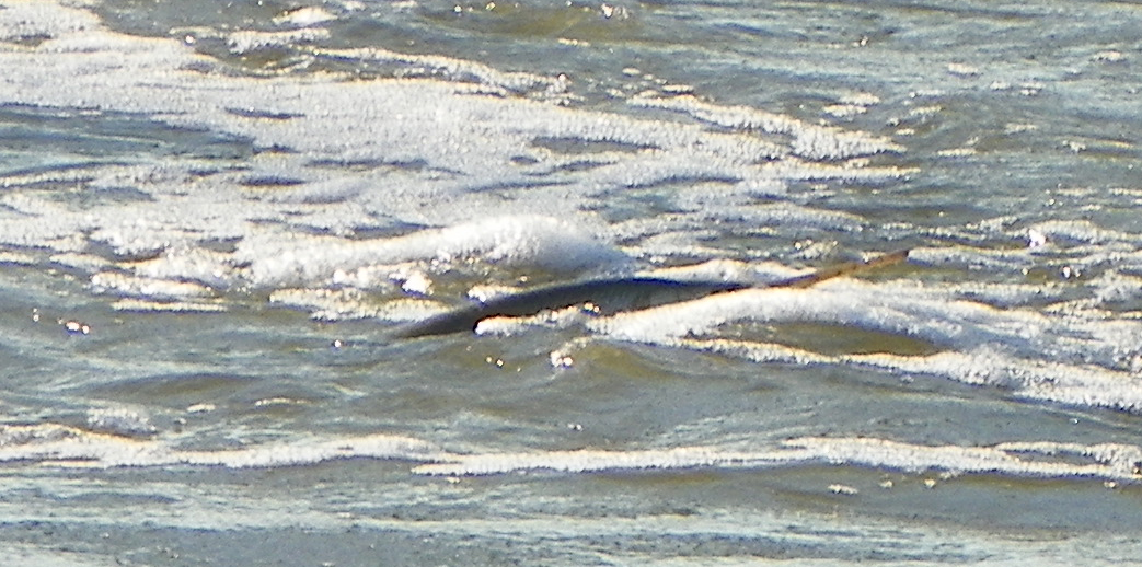 |
| Trophy Sized Longnose Gar Surfing The Standing Wave |
Sprinkle in some foamy swirling water, a disturbed water column and bait fish you have a perfect environment for big gar. This is not the place for canned corn and Snoopy Zebco fishing rods! The anglers pictured here are more geared up for a fight than a quiet evening of fishing. Steel leaders, surf weights, stainless steel hooks, heavy gloves, pliers and machetes. Not the normal tackle one would think of taking on a fishing outing. The gar above, a Longnose Gar was in the surf below the second wave. I would guess it to be near record size for the State of Texas and would easily be a water body record for the Trinity River.

These guys often fish between the mouth of Cedar Creek and the Standing Wave where they told me they encounter 4-5 foot gars. Serious, serious business. I think with the gaining popularity of reality TV shows featuring people hand wrestlin’ fish or grabbing animals that can bite back…there has been a mushrooming rise in the popularity of catching these fish. The Dallas Wave has become a hot spot as a result. Sad to see it silt in so fast too. In some places directly below the second structure, the water is only knee deep and a shoal has formed.

I’m glad to see so many diverse user groups of people using the Trinity River near Downtown. The more “normal” folks using the river for recreation, the fewer “bad” folks will use it in a nefarious manner. I think when the 1998 Bond Program was adopted, that was the original intent. Not a freeway. Not roads, concrete and tolls. But a place for people to use and explore. That’s happening. Finally.