Trinity River Trail Between The Levees Becomes A Reality
 |
| Newly Paved Trinity River Bike Path, November 1st, 2012 |
A planned multi-use path between the Trinity River Levees near Downtown Dallas took a step closer towards reality in the first week of November 2012. This first segment runs from I-35 to the Santa Fe Trestle Trail on the south side of the Trinity River in Oak Cliff. The brainchild of city council members Angela Hunt and Scott Griggs, this new paved path will connect four different city parks in Oak Cliff and provide off-street infrastructure down the Trinity River Corridor.
This trail is advertised to run from Sylvan Avenue to the Santa Fe Trestle Trail and run a little over 4 miles in length. Connecting various city parks, an overlook and future bridge crossings, the trail will be useable by many different neighborhoods on both sides of the river.
The trail was first announced in mid-August and construction was to be funded by 2012 bonds. Maybe that funding source changed and construction was able to proceed much sooner than thought. With a slated completion date of 2014, this first leg of a Trinity River trail is a welcome surprise.
 |
| Trinity River Trail meandering along south bank of Trinity River Dallas, Texas |
Like many, I thought the all encompassing 1998 bond election for the Trinity River Project included recreational amenities like bike paths inside the Trinity River Floodway. Apparently this was not the case. For the last decade millions of eyeballs have glanced over guardrails of the freeway bridges hoping to spot something that resembles a park, a bike path or even a solar powered taxi. While many projects like the Audubon Center have been a great success, few others especially around Central Dallas have seen the light of day.
The frustration was shared by many and became the butt of many jokes. Thoughts turned sour when the Trinity River “parkway”, which we all though was a way-to-the-park, was really East Coast Yankee lingo for a tollroad. Fooled us hayseeds!
 |
| Construction workers sawing expansion joints in the new Trinity Trail |
The Post-Katrina Corps of Engineers
Hurricane Katrina exposed the soft under belly of the nation’s aging levee system. The old levees that were over topped, undermined and failed in New Orleans were in many cases built to the same standards as the Dallas Levees. Dating back to the 1930s and built over a loose conglomerate of water permeable sand, the levees no longer met some of the flood protection guidelines set forth in a post-Katrina standard set by the Corps of Engineers. You could hear the money from the 1998 Bonds and the Trinity River Project just being sucked down the drain, tens of millions of dollars at a time with new requirements for flood protection. The money for fun stuff, the trails, parks and playgrounds evaporated.
 |
| Trinity River Trail looking west towards I-35 |
In addition to new flood protection standards, the Corps placed new requirements on construction in and around levee floodways. In Dallas, the floodway is designed to move water as efficiently as possible away from Central Dallas. Any new construction could not impede that. In order for the Corps of Engineers to approve a bike trail, it had to meet road standards, in this case 16 feet wide and thick enough for maintenance vehicles. The maintenance road aka multi use bike/hike trail is what we see under construction now.
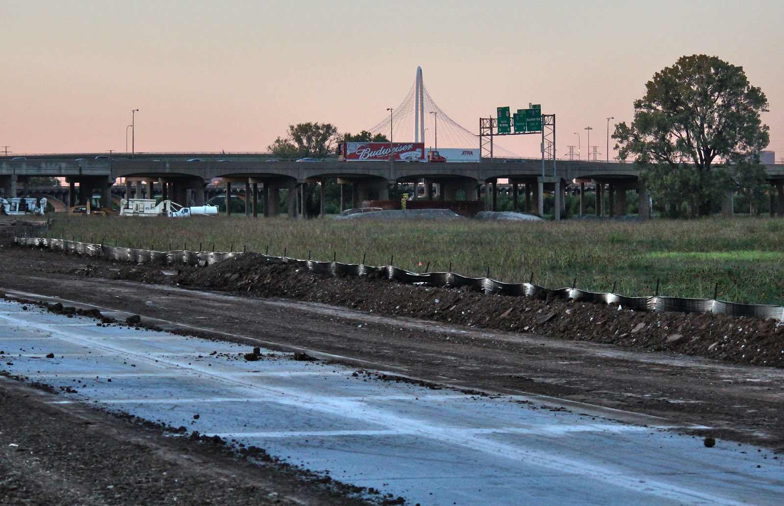 |
| I-35 and Margaret Hunt Hill Bridge as seen from the new bike trail |
I know many would have liked to have seen a natural surface trail here constructed with decomposed granite or mulch. The reality is, that could never happen. The concrete here will serve as a spine or backbone to other dirt trails in the future. I could easily see a series of casual dirt trails that lead from the concrete down to the river. White Rock Lake has a whole host of these smaller no-named trails that lead off into interesting scenic spots and features. Maybe each neighborhood on the opposing side of the levee could develop their own little 300 yard natural surface trail looping off this new concrete.
 |
| Late season Mexican Hat Wildflowers as viewed from new Trinity River Trail |
I would imagine for instance that with minimal effort a natural prairie could be installed here between I-35 and the Cedar Crest Bridge that would cost very little to maintain and provide a stunning backdrop for photographers, family photos or dog walkers. I was surprised to see so many wildflowers here this late in the season. Outside the heat island of Downtown, many areas of the Great Trinity Forest have already seen a first frost. As close as this area is to major vehicle arteries, it’s really pretty quiet down here.
 |
||
| Corinth Street Viaduct and new Trinity Trail |
There are thirty miles of dirt roads on and off the levees that are open to the public for non-motorized vehicles and foot traffic. Most are in great shape and easy to ride on a mountain bike or beach cruiser. There are few spots to access these trails and I would suggest just riding from Deep Ellum, Downtown or the Katy Trail. The Santa Fe Trestle Trail can be easily accessed from Riverfront Blvd on the north side or an annex lot for the Corinth Street DART Station at 8th Street and Parkway Avenue