 |
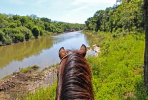
| Texas Trinity River’s Goat Island as seen from the saddle of a horse |
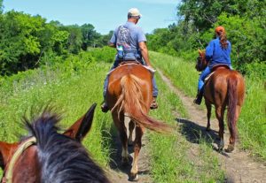
Some of the first European American explorers to see the Three Forks of the Trinity River saw what we now call Dallas, on a horse. Accounts of bison, bear and plentiful deer were likely scribbled in journals from a saddle. The heavy brush thickets, triumph in the face of adversity and taming the wilderness of North Texas all offer the horse as the focal point of discussion.
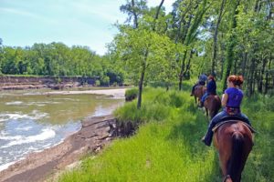 |
| Few see the Trinity in the natural channel like this south of town |
Much has been written about man’s exploration of the Trinity River by horse. The work to survey the land for settlement, the fierce battles to stave off Indian depredation, the eventual pioneer migration into Dallas County. The horse was a vital tool for traversing these bottoms.
The first settlers to this area were drawn by stories of the fertile lands, open range country and plentiful wild game. They were told that the land could be farmed so easily, that in a whole days of plowing one would not strike a stump, which were the constant enemy of cultivating in the other states.
Modern man has for the most part lost the art of riding a horse and the joy that can come from working with a horse over varied terrain and conditions.
The tall grass and weeds of the river barely reach the heels of your feet through this countryside. A delightful journey through thickets, dark shadows and bright wide open prairie.
 |
| Dueling Scissortails |
A horse with a fast lope and good company makes for a rewarding visit to Dallas County’s Goat Island Nature Preserve. With a wetter than normal spring of rains and flooding, seeing Goat Island on the established levee and old farm access road is a great adventure.
Completely staying off and avoiding the fragile mountain bike trails and footpaths, sticking to the dirt roads is best for the flora and fauna here who face a detrimental impact from horses straying off into the heavier brush.
Goat Island Preserve is a great place to ride as the established roads are hard packed and established with over a century of use. The roads date back to the turn of the last century when this was part of a large working farm.
 |
| Indigo Bunting |
 |
| Goat Island Preserve in Dallas County Texas, blue line is low road, red line is road following old Clint Murchison levee |
Address 2800 Post Oak Road Trailhead at 2800 Post Oak Road Wilmer, Texas
From Dallas take I-45 south to the Fulghum Road exit, head east where it eventually turns into Post Oak. Trailhead is easy to spot at one of the 90 degree bends in the road. New trailhead parking lot and sign note the entrance. Parking spots are marked for passenger vehicles but not trucks with trailers. Since few ever visit Goat Island, parking crosswise along 4-5 spaces seems the best option.
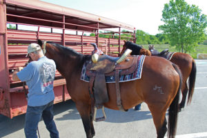 One or two parking spots exist at the Beltline Road bridge but are not formal parking like the trailhead up the street on Post Oak.
The higher levee road(in red on the map) follows the top of an old levee road which runs the length of the preserve south to Beltline Road. The lower road which runs between borrow pits for the levee and the Trinity River is slightly to the east and meets the upper levee road at Beltline. A high water table in the area ensures that even during the driest of weather that the low road stays wet and muddy in spots.
Distance Six miles out and back to Post Oak
 |
| Jeff Lane |
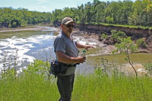
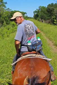 Jeff Lane and his family have been horseback riding in South Dallas for generations. For decades Jeff has been riding the river. A lifelong resident of the general Fruitdale area. Fruitdale was three miles south of downtown Dallas in central Dallas County. Some folks call it South Dallas or even South Oak Cliff. Fruitdale is the name.
The annexed land is now bounded by Fordham Road on the north, the Missouri, Kansas, and Texas tracks to the east, Five Mile Creek on the south, and Sunnyvale Street to the west. It was in the original land grants of J. K. Sloan and G. L. Haas. In 1886 the Missouri, Kansas, and Texas Railway was extended through Fruitdale. The settlement remained a quiet farming community into the twentieth century and annexed into Dallas October of 1964.
Through the 1990s and early 2000s Jeff tells me he had a volunteer agreement with Dallas County to mow areas around what is now called Joppa Preserve (River Oaks Park) and Goat Island. This basic maintenance with a tractor towed mower allowed access to horseback riding in Southern Dallas County. In addition to riding all over the river on a horse, he can often be found riding a bicycle along the Trinity Trail system from Loop 12 to the Audubon Center in the evenings.
The lone cowboy noted in western lore never really reached this part of Texas. The hardened cowhands and the free range of cattle bypassed this area as western migration moved those pursuits west rather quickly. What Dallas did develop was a rich horse tradition based upon families riding their 640 acres of land, known as a section, awarded for service in struggle for Texas Independence or later during Peter’s Colony settlement. A square mile of land often separated neighbors. The horse is what closed that distance.
The Low Road
 |
| On the low road, which is always wet. Always. |
 |
| Up on the terrace headed down into the bottoms |
Goat Island Preserve features two cutoff meanders that create islands in the river channel when the water is high. On the west bank of the river a large 1910-1920 era levee exists that runs from Post Oak to Beltline Road. Borrow pits rest on either side and a lower dirt road trail runs between the levee and the river. Towering oaks and pecans are prominent here among succession forest. Lock and Dam #2 sits on the Trinity River just upstream of the Beltline Road bridge.
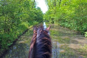 |
| The low road seen from the saddle |
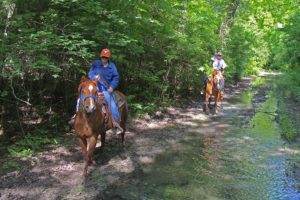
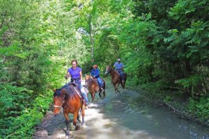
Poison ivy runs ten feet tall on either side of the low road in spots. The only way to travel is to just ride through the water, about 6 inches deep. Clear enough with a visible bottom, the horses love it. Some places it is hard to keep the horse from taking a friendly roll into the puddles where they can play.
 |
| Lots of playful splashing, horses love this kind of water |
The rough leaf dogwoods are in full bloom in late spring here, sitting 10 feet high on a horse allows one to get a great view of some low trees and shrubs that cannot be seen from the ground.
The flooded road would make for a horrible hike and a terrible bike ride. Both those activities would be impossible. A horse can negotiate it all fairly well and other than the wicked swarms of mosquitoes it is very enjoyable.
 |
| Jeri D’aurelio and her horse along the Trinity River at Goat Island |
About two miles from Post Oak Road’s parking lot, the low road opens up and follows the river down to Lock and Dam #2. Recent rains and flooding have severely eroded the bank in many areas, slowly encroaching on the old lower road. Trail Steward Joe Johnson said that vast stretches of river in this area are losing their banks and trees at an accelerated rate.
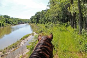 |
| In the far distance, Lock and Dam # 2 appears |
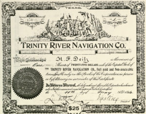 |
| Stock Certificate for Trinity River Navigation Company |
On quiet and windless mornings you can hear the roar of Lock and Dam #2 before you can see it. A folly in man’s quest to change the river. A folly in idea and design to build something in the riverbottom that would never fit. Every generation takes their own design to the river and it never works.
Trinity River Lock and Dam # 2 sits just upstream of Beltline Road. There are three locks on the Trinity River in Dallas County, #1 at McCommas Bluff, #2 at Parson’s Slough/Goat Island and #4 near the mouth of Ten Mile Creek/ Riverbend Preserve. All were built between 1910 and 1916.
The locks and dams in Dallas County never saw much river traffic. The idea to harness the power of the Trinity into a navigable water way was abandoned shortly after World War I in 1922.
Leaps in technology with long haul trucks and improvements in road and rail capacity sidelined the effort to move commerce via the river. Ideas at rebirthing the locks and dams on the Trinity came in the 1930s, 50s, 60s and 70s. These ideas were fanciful pursuits for the most part, grand visions with no science to support the effort.
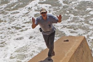 |
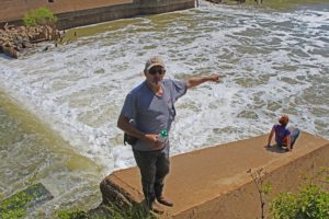
| Jeff Lane checking out the dozens of alligator gar in the foaming water below the dam. |
Today we are left with the concrete foundations of the locks, twisted metal and fallen flood gates. Lock and Dam #2 is the most photogenic of the locks in Dallas County. The water literally roars here with long vista like approaches on either end. The other locks are constrained to some extent in the river channel and don’t have wide eroded pools on the downstream side.
Video of Lock and Dam #2 and Horseback Riding Goat Island
Each Boule Gate that was used in the lock was 24 feet high, 30 feet long and weighed 60,000 pounds. One gate formed half of a door, 1 door on the upstream end and 1 door on the downstream end completed the lock which was designed to raise and lower boat traffic.
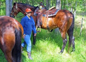 |
| Michelle Lane checking her horse in a grove of cedar elms at Lock and Dam #2 |
The construction of Lock and Dam # 2 required the closing of a subchannel of the Trinity called Parson’s Slough.
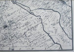 |
| Old map of Bois D’arc Island and Parson’s Slough |
The idea was to cutoff a 14 mile stretch of the traditional stream bed for a more westerly course putting all water in one channel of the Trinity. The old riverbed became known as Parson’s Slough and the 22,000 acre area surrounded by the new and old river became Bois d’ Arc Island.
 |
| Jeri D’aurelio and Michelle Lane at Lock and Dam #2 at Goat Island Preserve |
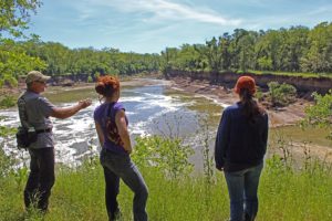 |
| Trees, some rather large are calving off into the river below the lock |
In 1911, the slough was permanently cutoff from the Trinity River near Goat Island Preserve. The same construction company that built Lock and Dam Number 2, built a concrete dam at the head of Parson’s Slough where it meets the Trinity. Twenty feet high and two hundred feet wide, the goal was to permanently send the river down the new channel rather than risk a flood putting the river meander back in the old. Now buried under dozens of feet of silt, it cannot be seen from the west bank.
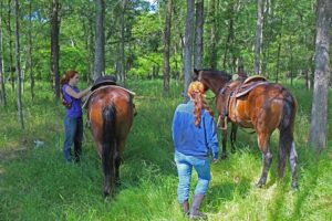 |
| Mounting up and heading further towards Beltline |
It sits near the outflow channel near the Southeast Wastewater Treatment Plant. Buried. Only during times of the very highest water flows would the dam become a spillway.
Combined with some levee projects in the 1920s, this left Parson’s Slough high and dry from the Trinity. The flood prone area now known as Bois d’ Arc Island now serves as some of the very richest farmland in Dallas County. Much of which is owned by Trinity Industries for future gravel mining.
 |
| Through some young woods of Ash and Cedar elm, approaching a powerline right of way that connects the low and high roads |
The Upper Road
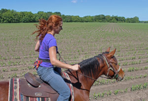 |
| Riding just outside the edge of a Dallas County corn field |
The higher levee road(in red on the map at beginning of post) follows the top of an old levee road which runs the length of the preserve south to Beltline Road. Until recently, trees and vegetation were allowed to grow on the levees. The clearing was to maintain the functional facility for higher flooding events on the west side of the Trinity. I would believe they offer marginal protection since they have not seen earthmoving improvements in so long.
The old levees today most likely still perform the job they were originally designed to provide. Protection from all but the very worst flooding that the Trinity River can dish out. These levees are about half the height of the Downtown Dallas levees and hold back the seasonal and annual floods of the Trinity. Beyond the levees millions of dollars in corn grows. A crop that would drown if flooded.
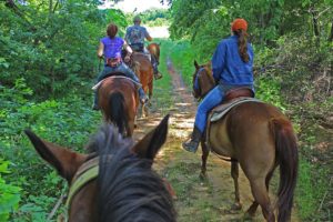
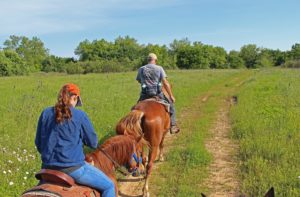
The dirt road here is much more open than the lower road. Here two horses can ride beside one another and conversation is much easier. There are only a few surprises along the route of note. In a few spots there has some been bore sample drilling of the levee with grass covered holes left behind. Care needs to be taken in watching for the holes which are just off the road in the high grass.
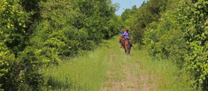 |
| Time to kick it up a notch and letting the horses run on the smooth section of levee about a half mile from the end of the ride |
The levee affords a great chance to loosen the reigns and pick up some good speed in a lope, or even faster. Lots of photos on the ride down the lower road, not many on the high road back. Lots of up tempo faster riding were the order of the day here where the horses were let loose to run. Hard to manage an SLR in one hand and ride a horse 20mph with the other.
Where to ride your horse in Dallas on the Trinity River
Often people ask me where to ride their horse. Goat Island is the place. There are a scant few other spots like Dowdy Ferry @ I-20 at the Gateway Park there but the options will become much more restricted when the trails are paved over with concrete.

