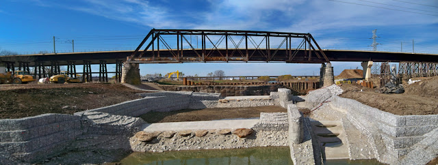
First official flood for Dallas Waves, Trinity River Whitewater Project
The evening of April 4th, 2011 marked the first time since the completion of the Dallas Waves aka the Trinity River Standing Wave that it faced total inundation by the Trinity River. The coffer dam was removed in late December of 2010. Since that time the Trinity River watershed above the project has not received enough rainfall to submerse the site. I was half hoping to see gigantic rooster tails of deadly whitewater similar to what one might find on the Colorado in the Grand Canyon. No such luck. I imagine there must be a sweet spot around 1000cfs where the river is the most surfable.
Park is set to officially open in early May 2011. Another project on the same site, the Santa Fe Trestle Trail will allow bike and foot traffic a place to cross the river. It has a planned opening in the Fall of 2011 with improvements to Moore Park on the Oak Cliff side of the Trinity River.
 |
| Dallas Waves, Trinity River as viewed in a dry state 3 days before Trinity River returned to normal bed |
I have casually followed the project since it was nothing more than a set of survey stakes hammered into the ragweed along the bank of the river in June of 2010. I visited the site numerous times over the course of the summer because it afforded an easy place to cross the river via mountain bike when I was out on training rides along the levees.
Location:
Currently one can reach the Dallas Waves, Standing Wave from either the north or south levee of the Trinity. Seems that most visitors prefer the Oak Cliff or south side since it can be reached by parking at the Corinth DART Rail Station or on the gravel access road near the construction site. Most of the amenities like put-in ramps, take-outs, viewing area etc are on the Oak Cliff side of the river.
The other access point is via the north side of the river where Riverfront (Industrial) Blvd dead ends at a gate. Walk from there.
Both entrances are roughly the same distance from the river. The Oak Cliff side offers a better view of Downtown and easier access to the river.
 |
| Old AT&SF bridge with DART bridge behind it prior to construction June 2010 |
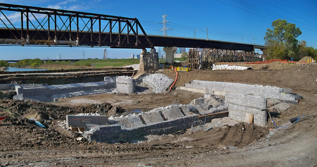
By July of 2010, a diversion channel was built to detour the Trinity from its bed to allow an in-channel set of obstructions that are designed to create a “standing wave”.
 |
| Cofferdam in place |
 |
| Diversion Channel of Doom |
When the water was diverted out of the old Trinity River Channel it created a slightly narrower, steeper, rocky version of the old bed. The result spelled doom for some inexperienced river goers who had rented some canoes earlier in the day. I believe there were a couple of superficial injuries and some finger pointing between the city, contractor and the canoeists in regard to liability and overall safety.
In the video above the water does not look too dangerous until you realize it’s only a couple of feet deep and armored with sharp rocks.
 |
| Temporary construction bridge over diversion channel prior to river being diverted |
 |
| A bone dry Trinity River bed |
 |
| November 2010 |
 |
||
| December 2010 |
Trinity River Standing Wave with cofferdam 25 percent removed in December 2010. During a “normal” flow, the structure looks just like the video above.