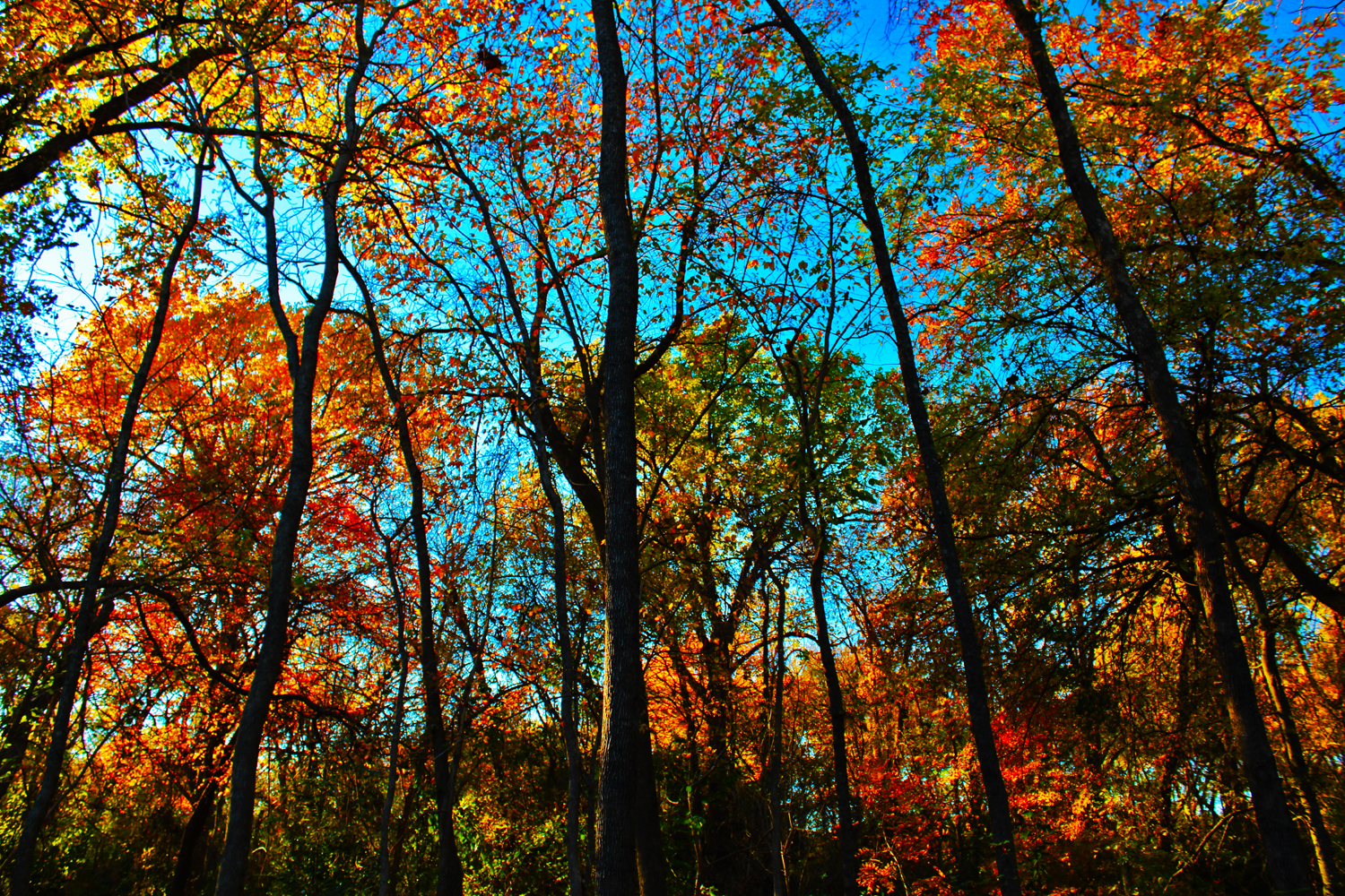
Fall Red Woods of the Great Trinity Forest
 |
| Piedmont Ridge Trail Overlook, view towards Oak Cliff Bank Tower on horizon |

The bottomlands beyond the escarpments lie relatively unwalked and unexplored for years at a time. The towering second growth trees sprinkled with old growth is one of the greatest places to explore in the city. A place that lacks roads, trails and the construction work of 21st century man. Beavers do the construction here ten feet of dam at a time. Here they are slowly transforming the once channelized and de-watered White Rock Creek for Grover Keeton Golf Course back into a permanent marsh. A quiet and near impossible place for humans to venture. The fingers of the Trinity River Project do not reach down here. Nor will they. Wet nine or more months out of the year this backwoods area will always remain as it looks today. Those with a degree of rare country sophistication would appreciate a place like this.
 |
| Bruton Bottoms in the Great Trinity Forest |
Those looking for a quick hike covering lots of ground need to look elsewhere. Traveling here is a thinking man’s game where arduous bramble thickets should be viewed as a place to slow your pace and drink in the scenery. It’s a pleasure to walk down here looking for the few and far between bois d’arc fencelines left by post cutting pioneers. Duck canvas pants and a thick pair of work gloves will take one far here.
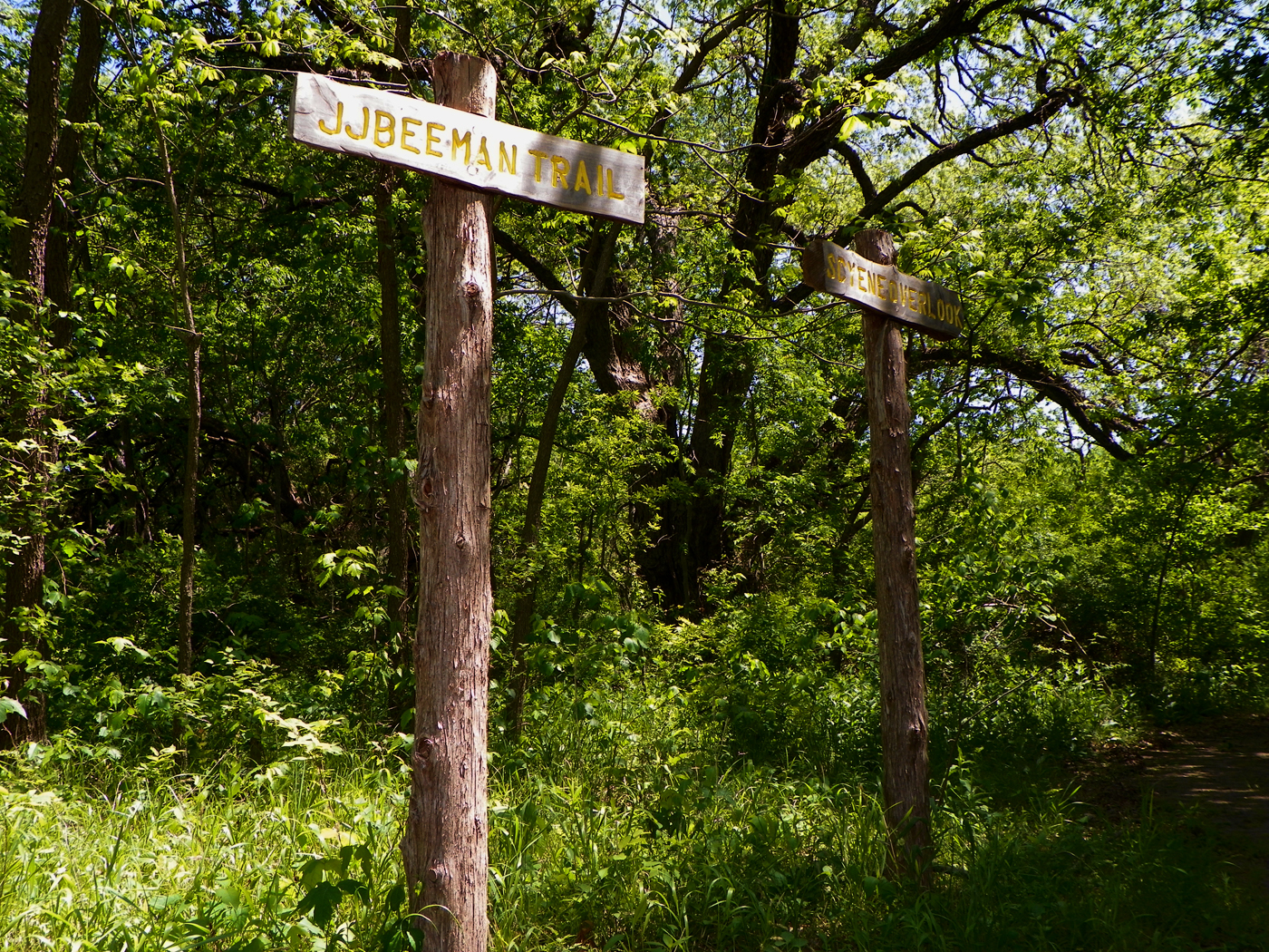 |
| JJ Beeman Trailhead sign |
Like much of the Great Trinity Forest this land was settled by the Beeman family. Granted 4th class headright by the Republic of Texas in November of 1842, exactly 170 years ago, James Jackson Beeman’s 640 acres were roughly between what is now Scyene and Bruton near present day Jim Miller Road. A trail west of the Scyene Overlook bears his name that if were more frequently maintained would reach the Lawnview DART Station.
JJ Beeman is an important figure in North Texas history. On President Sam Houston’s visit to White Rock Spring in the summer of 1843 it was JJ Beeman who guided Sam Houston’s Treaty Party from their overnight camp at Big Spring up White Rock Creek to John Neely Bryan’s cabin in what is now Downtown Dallas.
 |
| Sam Beeman, Mrs John Neely Bryan Sr, John N Bryan Jr |
Many paths crossed on that Treaty Party trip. Whether the long lasting friendships were forged before this meeting I do not know. In the proceeding years many of these men would meet together again fighting under the stars of three different national flags. The Texas Lone Star, The 28 Star American Flag and the 7 star flag of the Confederacy. John H Reagan a member of that treaty party later became US congressman, Confederate Secretary of the Treasury and post-reconstruction US Senator. Reagan and Beeman had a mutual friend in Nathaniel Burford . After Beeman returned from the California gold fields as a ’49er, he land swapped his White Rock Creek holdings for land in Parker County. Beeman built a fortified stockade out there called Beeman’s Fort. Under a large oak on Beeman’s property, Nathaniel Burford held the first district court session for Parker County. The tree, known as the District Court Oak still stands today.
He must have been a restless sort, holding the job titles now trademarked by every professional sports team in DFW. Texas Ranger, Dallas Cowboy, Maverick, Rough Rider. His constant travels across Texas and the West make him all but a minor blip in most Dallas histories but he deserves more credit for what he did here in Dallas.
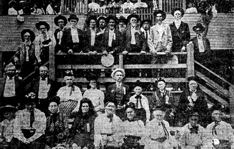 |
| Pioneers of the Trinity |
 |
| Thunderhead over Beeman Cemetery |
The old worn faces in the photo above represent many of the people I have mentioned in previous posts. The Beemans, Cochrans, Bryans, Hunnicutts, Fishers and others gathered at a pioneer reunion at Oak Lawn at the turn of the last century. Most of those pictured were born, lived and buried in what we now call the Great Trinity Forest. Mrs Margaret Beeman Bryan seen bottom row, second from right was married to Dallas founder John Neely Bryan and lived for many years at White Rock Spring now located down pasture from the Pemberton Farm. Her relatives, cousins and neighbors fill the photo.
Many of those folks now rub shoulders at the Beeman Cemetery just like they did in that old photo. I would hazard a guess that two-thirds of those in the photo now lie in repose there. Sitting on a hill, a stones throw from the upper limits of White Rock Creek’s floodplain the old cemetery was chosen as a garden spot of a cemetery by John Beeman in the 1840s.
The Trails

The archaic and sun damaged topographical map I once pointed people towards at the Piedmont Ridge Trailhead kiosk no longer exists. Removed or taken I do not know where it walked off to. The trails here really don’t lend themselves to a map since they become difficult to follow in some areas. At best all I can offer is the GPS data map overlay which gives somewhat vague reference points to the Lawnview DART Station(green), Renda/Laceywood Trailhead(top yellow), Grover Keeton(middle) and Devon Anderson(bottom). The ideal parking location is inside the Grover Keeton golf course lot, west of the DART tracks. This allows for an out-and-back hike from the safest parking area.
The Lawnview DART route now requires a heavy bushwhack and not recommended at this time.
 |
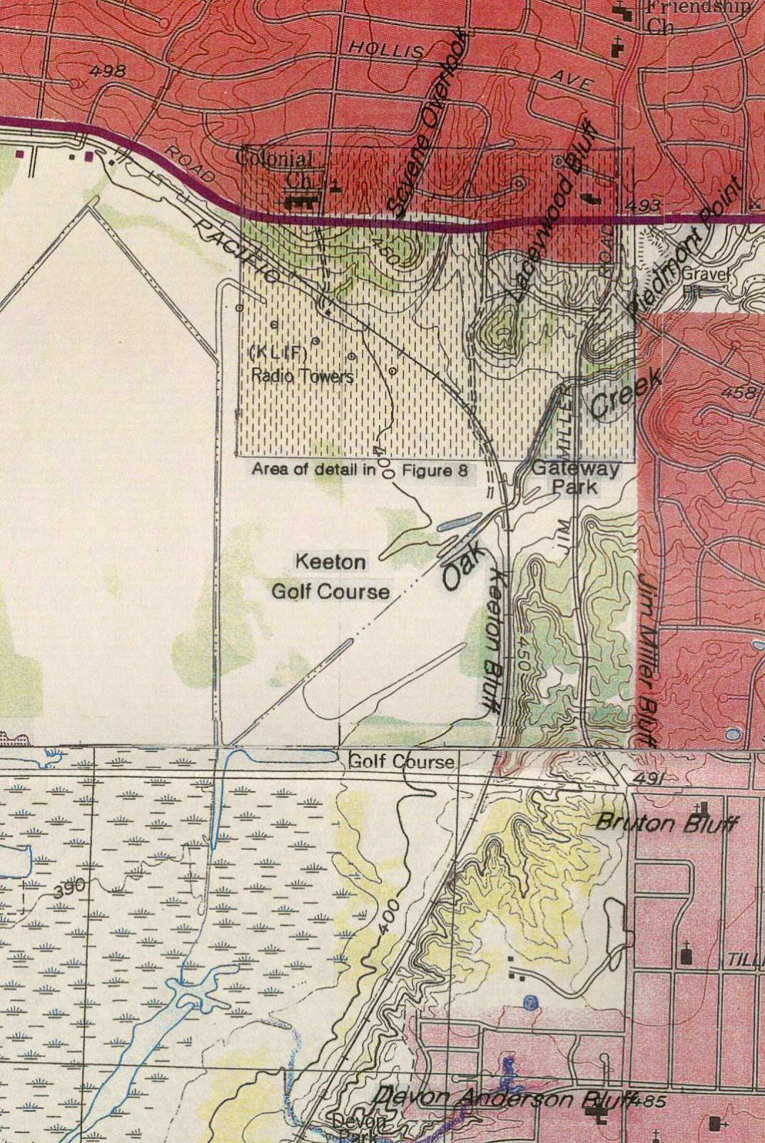
| Hutchins quadrangle annotated with Scyene, Laceywood and Piedmont Overlooks. Map credit Tim Dalbey |
 |
| Click to enlarge map credit Tim Dalbey |
I have included the USGS quad for Hutchins which gives topo beta for the trail and overlooks in the area. Access to the west side of the DART Green Line ROW can be made on foot or bicycle from a DART gravel road near Glover Pass, Grover Keeton Golf Course or a bridge underpass just south of Bruton Road. A parallel set of train tracks sits slightly off grade from the DART light rail. This seldom used rail line is rumored to serve the Dal-Tile plant on I-30 from time to time. It sits outside the DART fences and given the amount of excess ballast used in maintenance almost lends itself to a halfway rideable route on a mountain bike.
The marsh notations south of Bruton are “Bruton Bottoms”. I would only attempt an excursion down there with a group, good GPS, a fresh roll of flagging tape and a good head on your shoulders.
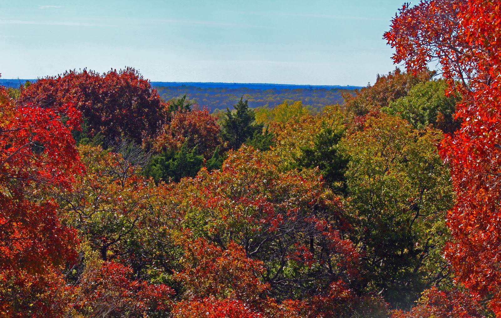
Scyene Overlook
 |
| Scyene Overlook |
The best known overlook in this trail system is Scyene. Roughly one hundred yards south of the road bearing the same name the overlook gives one a commanding view of the Great Trinity Forest to the south. Most days the VA Hospital, Wilmer/Hutchins water towers and the aerial towers on Cedar Hill are visible with the naked eye.
 |
| Scyene Overlook |
This overlook is named for an old frontier town two miles east of the overlook named Scyene. The town center was at the present day intersection of Scyene and St Augustine . The name “Scyene” is a play on the ancient Egyptian town named Syene an old frontier outpost on the east bank of the Nile. Around 500 BC, the same time the Book of Ezekiel references the ancient Egyptian town of Syene (Aswan), some ancient Native American left behind a Gary dart point(arrowhead) here on the bluff. Stories as old as the Old Testament were probably told here along what was an old Bison Trace which later became Scyene Road.
The millennium old natural bison path and hard bottomed ford of White Rock Creek made this a preferred ox pulled wagon route into Dallas prior to the railroads. The long haul interstate truckers of their time.
In the last month, historian MC Toyer and archeologist Tim Dalbey have been out on a field trip or two in this area checking into a possible gravesite of outlaw Belle Starr’s family and an old post Civil War era cabin in the Parkdale neighborhood(a few blocks from the overlook) that has a contemporary veneer on the exterior but logs/planks underneath. Owned by a well known local artist it might be one of the oldest structures in Dallas still on the original foundation. Or not.
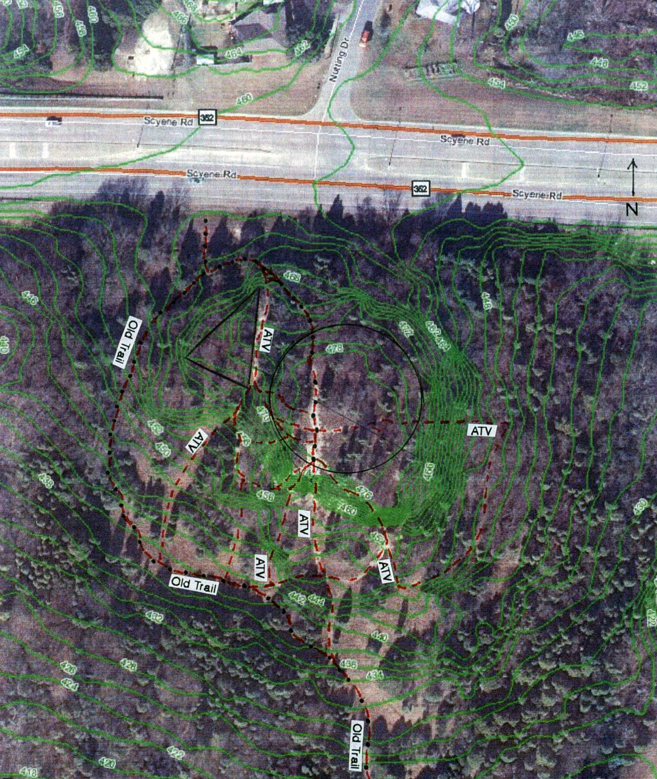 |
| Scyene Overlook map. Credit Tim Dalbey |
The pounded down rocky rat holes left behind by years of off road vehicle use at Scyene Overlook have made deciphering the old ATV trails from new hiking trails quite difficult. Looking at the eroded gullies one can imagine these were used in hill climbing contests for motorized dirt bikes and off road vehicles at one time. Gazing the topographic map above with trail overlay one finds it difficult to make sense of what route to take. The Groundwork Dallas trail is unmarked, unblazed and ripe with deadfall making for a puzzle of a walk. Follow your own line here and you’ll be fine.
Orchids- There are five species of Hexalectrus orchids that are found in Texas out of seven species worldwide. Out of these five, four occur in Dallas County. In the most recent orchid census, Scyene Overlook had the third highest number of orchids in the county, all were the H. spicata spicata species. The orchids here are quite rare and rely on a specialized relationship with soil fungus to acquire their carbon rather than sunlight. These species cannot grow under artificial conditions or be propagated by humans.
At one time, the city wanted to pave Scyene Overlook’s trail and place an observation tower on top of it so that visitors could view Downtown from a distance. One of the rubs is that visitors cannot see Downtown from this vantage point. To do that one need only cross the Renda Meadow to Laceywood Overlook.
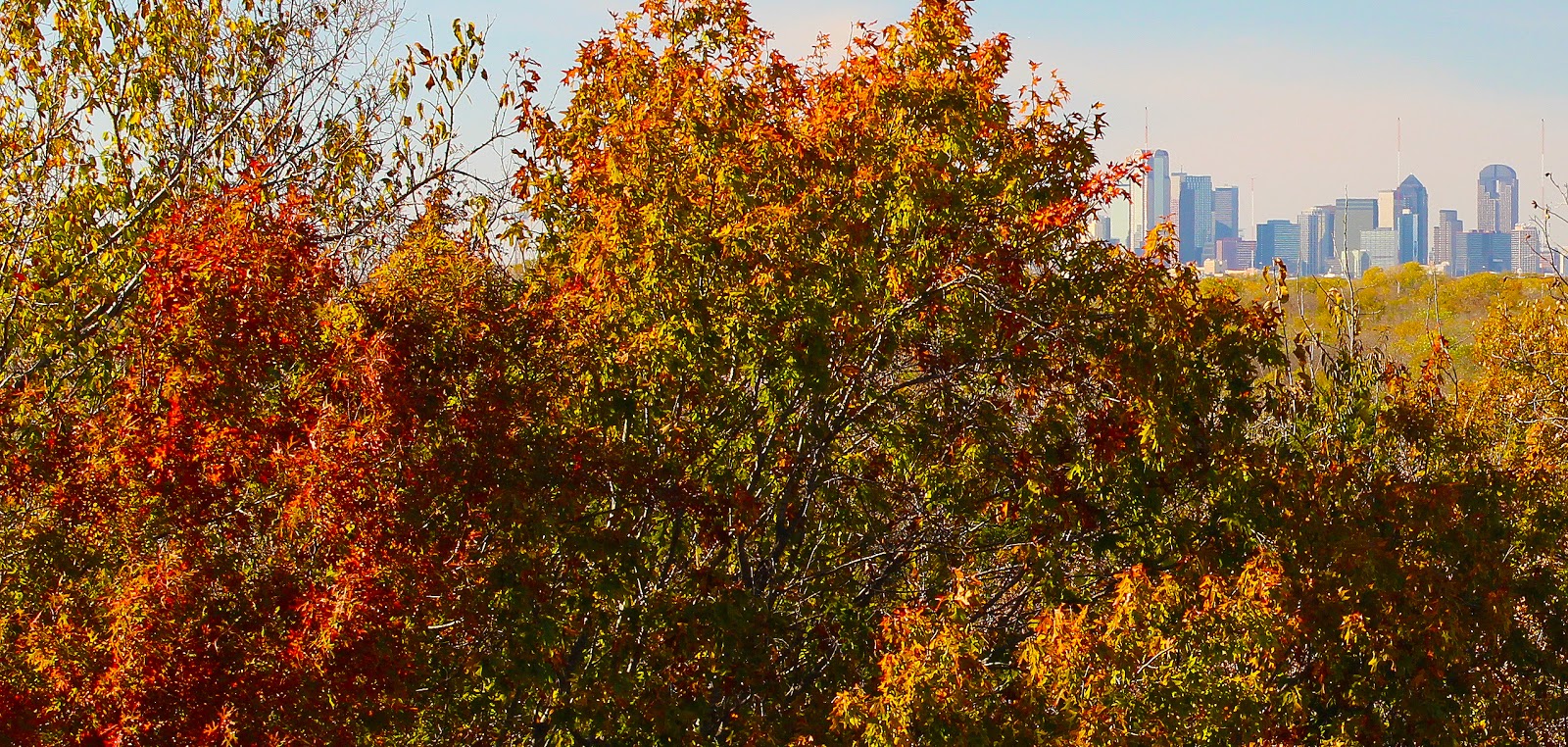
Laceywood Overlook– The overlooked overlook
 |
| Tree covered Laceywood Bluff |
A mere footnote to Scyene Overlook, the Laceywood Bluff is everything Scyene Overlook is not. Sitting at the same elevation as Scyene but oriented north to south and facing west, Laceywood Bluff offers a great view of Downtown Dallas few ever see from the east. The tawny colored facade of fall oaks hide the brilliant white outcropping beneath.
 |
| Cottonwoods along unnamed brook through the Renda meadow |
A five acre, tall grass meadow stands between Scyene and Laceywood with a small intermittent dry wash peppered with cottonwoods and willows. Reaching the meadow is best done from Gateway Park on Jim Miller as no formal parking exists on Renda or Laceywood. Both of these trails would be great for dog hiking.
 |
| View of Downtown Dallas from Laceywood Bluff |
Laceywood sits fifteen feet higher than Scyene and the afforded extra elevation barely clears the tops of the highest pecan trees in the creek bottom below. That lends itself to a great set of pocket views featuring Downtown Dallas as a reward from the top. Two or three very informal foot trails lead to the top. One starting at the Renda Meadow which is rather steep and the other a longer and more pedestrian route from the baseball fields in Gateway Park.
 |
| Sumac on Laceywood Bluff |
Piedmont Overlook

The Piedmont Overlook sits east of Jim Miller and can be best accessed from Gateway Park on Jim Miller. Hop across Oak Creek and begin the climb from the south. The west facing slope resembles scree and far too loose to hike up. Kicking rocks loose in this area would end up on Jim Miller vehicle traffic below.
The elevation of this bluff is the same height as the Laceywood Bluff and therefore is blocked from a view of Downtown Dallas. No formal trail exists that I know of. This is an orphaned section of bluffs that extend along the east side of Jim Miller from Scyene to Bruton. The road cut for Jim Miller bisected the rock feature here and left the eastern sections cutoff from the rest. I have wandered around some south of Gateway Park on the east side of Jim Miller and have not found much of note.
Many of the larger trees along Oak Creek in a residential neighborhood that back up to Gateway Park pre-date pioneer settlement of Dallas County. A recent postmorteum was done on a felled oak tree in the 2200 block of Santa Cruz. The Post Oak was dated at 134 years old with a radius of 11.99 inches.
Piedmont Ridge
 |
| Piedmont Ridge Overlook |
The most well established, easiest to follow and best maintained trail in this area is the Piedmont Ridge Trail that stretches from the Grover Keeton Golf Course entrance road, south to Bruton.

Climbing a short set of switchbacks puts one on a flat plateau of exposed remnant blackland prairie and lends itself to open sky views not afforded at other overlooks. Here you can usually see buzzards wheeling the sky, riding the warm thermals created by an ever present southerly breeze. The sweet smell of juniper on the hottest of days can transport one to the scrub of the Llano Estacado without ever leaving the city limits.

It’s a place where the old settlers mule teamed plows found the rocky ground to thin to work and their cattle found too steep to venture. Left to their own devices the old growth red oaks in this section of trail are most likely antique in age living prolonged sheltered lives of bourgeois pride on the limestone.
Devon Anderson
 |
| Devon Anderson Park |
The cryptic entrance to Devon Anderson’s trail near Bruton Road has cut many a hike short through the frustration of not being able to find it. Roughly 50 solid paces east from the DART ROW fence along a Chinese Privet hedgerow, the opening can be tough to find. The trail climbs through matted privet and up short sets of switchbacks to tree canopied sets of ridges and steep gullies.
 |
| The Half Mile Overlook |
 Intertwined behind a couple modular looking cul-de-sac’ed neighborhoods the trail runs north to south from Bruton to Eastcliff. There are two or three vantage points in Devon Anderson where one can see Downtown Dallas. Steep and off camber in most areas the trail does not lean well towards someone on a bike. More pushing than riding eighty percent of the time it’s best traversed on foot.
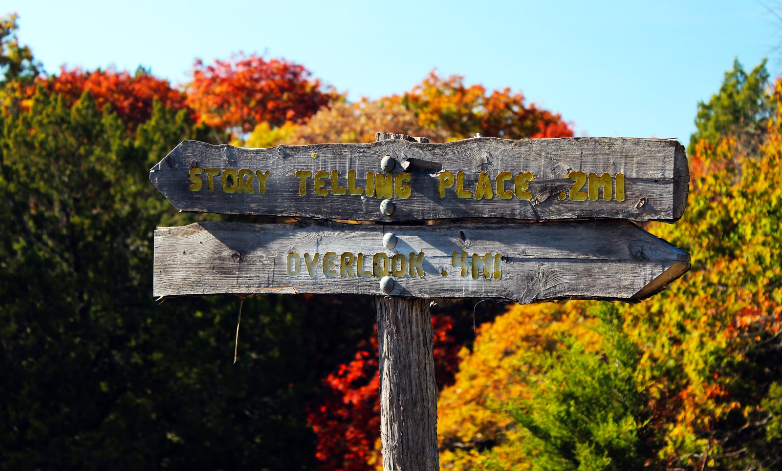
The wooded trail opens up into an open wildflower meadow near the trailhead junction of the overlook trail and Comanche Storytelling Place trail. The Devon Anderson Meadow is set afire from time to time by what are probably neighborhood youth. It burned down at least twice in 2012 that I know of. The coming spring will tell the tale of what ancient fire DNA lives in the seeds in the ground here.
 |
| Comanche Storytelling Place |
The Comanche Storytelling place serves as a prominent anchor to the southern end of the trails here. Beyond are steep root strewn gullies that lead nowhere. The Storytelling Place is something of a conundrum. The Comanche people named this natural ampitheater as a holy place in the late 1990s after a brief visit to an Indian Marker Tree that once stood in Gateway Park. The Comanche had no written language and used parables told orally to explain their people’s history. Parables like those of the seasons, the animals and planets all played a forefront role in Comanche lifestyle. The Storytelling Place combines a few of these elements including the cedar, limestone and elevation required for Comanche holy spot. Here under the fragrant decay of fresh fallen leaves one could imagine a small Comanche band retelling old animal stories before a fall hunt.